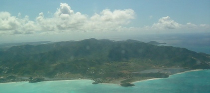
Antigua lies at the northern end of the chain of Leeward Islands, and is 108 square miles with an indented coastline of a total of 95 miles long, giving rise to the neatly coincidental 'fact' that the island boasts 365 beaches. Its sister island, twenty-seven miles to the north, is Barbuda, measuring 62 square miles. The nation also includes the uninhabited volcanic rock, known as Redonda, thirty-five miles to the west of Antigua, which has achieved notoriety because it is claimed as the literary monarchy, founded in 1865, and currently 'ruled' by King Leo. The aerial shot of Antigua (left) shows the island from the south, with the huge, protected, English Harbour on the right.
The island was settled by Arawak and Carib peoples when it was claimed by Columbus in 1493, naming the island Santa Maria de la Antigua. Attempts were made by both Spanish and French to settle the island, but the first European presence was English, with whom settlement began in 1632. A group migrated from St Christopher's (St Kitt's), with Philip Warner, son of Sir Thomas Warner, first governor of the Leeward Islands; joined by a further wave of English migrants after Surinam was ceded to the Dutch in 1667. Amongst the latter were major players, such as Francis, lord Willoughby of Parham, and William Byam, who wrote the following year that 'I have deserted our unfortunate colony of Surinam, war and pestilence having almost consumed it. As it is to revert to the Dutch, I have with great loss removed to Antigua, where I am hewing a fortune out of the wild woods'. The development of the island, in terms of a profitable colonial outpost, was largely the result of the efforts of Sir Christopher Codrington, who, in 1674, took over the plantation established in 1651 by Governor Christopher Keynell, named it Betty's Hope after his daughter, and went on to lease the island of Barbuda from the British Crown, reserving it for slave settlements. The plantation house and plant at Betty's Hope were in a ruinous state, but are currently being restored and the mill is now working.
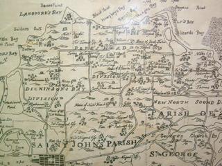
 If earlier maps of Antigua were made, they do not survive. The most complete visual account, which might give an indication of settlement, comes from Baker's map of 1749, of which a section of the north-west corner of the island, north of the capital of St John's is shown, right. Place-names often retained their original seventeenth-century connections, long after the eponymous individual had departed, such as Royal's Bay, on the north coast, named after Colonel Isaac Royall, who left Antigua for Medford, Massachusetts, in 1737, and petitioned the General Court for remission of the £4 per head duty on his slaves, whom he considered property and not intended for sale.
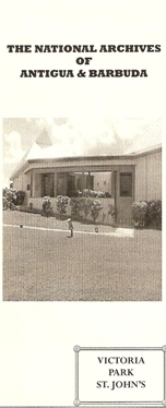
The Acts for the island exist in the National Archives, Kew, and also in the Antigua and Barbuda National Archives (est.1982). The latter is also the repository for the volumes of land grants from 1668; church records, some of which are too fragile with others open to view; Acts of the Assembly from 1690 (fragile); and the Codrington Papers, dating from 1700. The acquisition of the Codrington papers necessitated a new building, and since 1991 the archives office has been in Victoria Park, Factory Road, St John's.
The National Archives of Antigua and Barbuda, Victoria Park, Factory Road, St. John's.