How to use this site
The hope is that the structure of 'Mapping the Lakes' will be clear to follow. If you are particularly interested in one of the two writers, then please use the sidebar on the left-hand side to be directed to the relevant sections of the site: there you will find a range of contextual information on the writers and their work. The notes below, however, are designed to offer a suggested route through the site.
In constructing the pilot project website, we have tried to create a spatial narrative. In other words, we have endeavoured to suggest how GIS technology has the potential to be used in increasingly sophisticated and exploratory ways in the mapping of geo-specific texts. There are three main stages to this spatial, or cartographical, narrative.
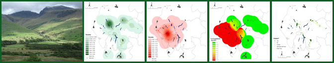
1) Base Maps: cartographical representations which map out the progression of the respective writers through regional space. These maps locate both Gray and Coleridge as historical figures whose texts provide an account of the movement through both time and space. Throughout the site, standard colours are used to map out the respective texts: green is used to denote Gray's movement through the Cumbrian landscape; whilst red is used to chart Coleridge's documentation of his 1802 tour.
2) Comparative Maps: these maps move beyond the base cartographies to set up direct comparisons between the two textual accounts of place and space. These comparative cartographies suggest ways in which GIS technology can be used to represent the spatial intertexuality of the Lake District landscape: the textual layering of place over time.
3) Exploratory Maps: the third cartographical tier moves towards the possibility of more abstract and exploratory mappings of literary texts. This section begins to use GIS technology as a tool for spatial criticism.
In order to develop a sense of the theoretical principles underpinning the pilot project, it is helpful to follow the cartographical narrative set out by the sidebar and to move from base to comparative to exploratory mappings of the two texts.
Once the range of GIS maps have been explored, the final sections of the site reflect upon the pilot project and move towards future research possibilities.
As the development of the 'Mapping the Lakes' website is a pilot project, funded by the British Academy, we would welcome your comments and suggestions on the site and its content. To contact the members of the project team, please follow the links available on the 'Contacts' page.