John Cary: composite map of north Furness and the Duddon Sands
John Cary New Maps of England and Wales with part of Scotland (1794); details from nos 58 and 47.
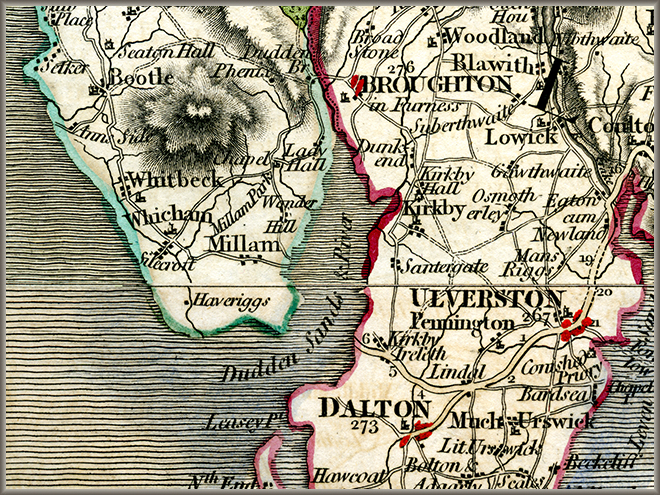
There are various possibilities about how Fox might have gone from Swarthmoor to Bootle. One route goes to the head of the Duddon estuary via Kirby and Broughton in Furness. He would probably strike east from Swarthmoor to Pennington (where there was a Meeting in later years), and then follow the road north past what is now Pennington Reservoir to join the road over Kirkby Fell at Horrace Farm. This would provide him with a stop-over at Miles Wennington's at Ash House, where he had recently been. He then had a choice of routes, either over the tops to Bootle, or round via Whicham.
Another possibility is that he went from Swarthmoor to Dalton in Furness, then on to Ireleth, and across the sands from what is now Askham to Millom. He could then go to Bootle up the coast road.
Image © Meg Twycross
Close window to return