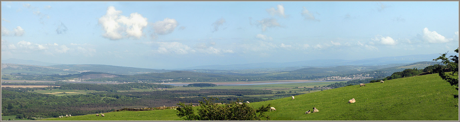
Kent Estuary from the side of Cartmel Fell
The lower reaches of the Kent Estuary as it debouches into Morecambe Bay. From left to right: Milnthorpe is hidden behind the quarry at Sandside. Then comes Storth and Carr Bank. Arnside is to the far right, almost disappearing behind the nearer hill-slope. The dark line of the railway viaduct can just be seen crossing the estuary. Unless you came across the sands, there was still a considerable distance to go round the head of the estuary to the Sampool bridge over the Gilpin and the Levens Bridge over the Kent. Sampool Bridge and the causeway were continuously being presented to the Westmorland Quarter Sessions from the 1650s onwards as being in great decay and in urgent need of repair. When the causeway was flooded in winter, travellers had to go yet further up to Kendal and Underbarrow. The route was finally turnpiked in 1818.
Image © Meg Twycross 13 June 2009
Close window to return