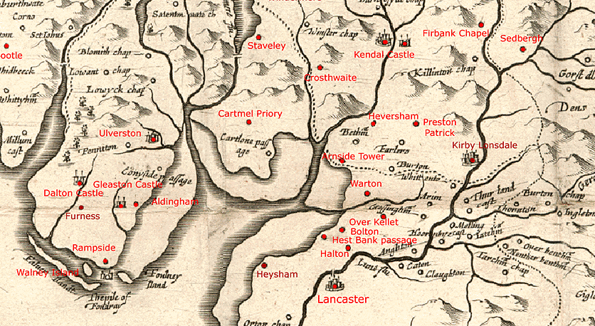
A reduced version on six sheets of the 1583 Saxton map, known as the ‘Quartermasters’
Map’, engraved by Wenceslaus Hollar, published by Thomas Jenner.
Hills and rivers are shown, but no roads (the dotted lines are the county boundaries of Lancashire and Westmorland).
Settlements and chapels are marked, as are Morecambe Bay Sands and the starting points of the passages across
them, Conishead, Cartmel, and Hest Bank.
On this version, places visited by Fox have been marked in red.
Image © Ian Saunders