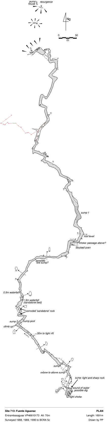
713 Fuente Aguanaz
San Antonio VP46610173 Alt. 70m Length 1691m Depth 21m
Updated 19th February 1999; 6th May, 16th October 2001; 5th November 2005
The cave is a major resurgence for the area and a large diameter pipe removes
water supplying Santander. Information gleaned from the Dirección
General de Obras Hidráulicas y Ciclo Integral del Agua in 2005
shows an average water flow from the resurgence over the previous 20 or so
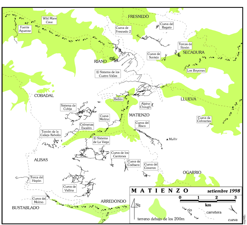
years of 951 litres per second. (The Matienzo / Riaño water resuregence
at Los Boyones emits 650 litres per second on average. Unlike the 4 Valleys
System, there are currently no known feeders or caves which drain to the
Nacimiento de Aguanaz). The resurgence area has been turned into an outdoor
interpretation centre with 4 boards explaining about water and the environment.
Further boards are in the old pump houses.
The water level at the bottom entrance is at about 50m altitude and is reached
by a climb down. Sixty metres up behind this - reached by a track setting
off on the right of the car park - is a hole below a scar in a shakehole
which is where the pipe reaches to abstract the water. The entrance for cavers
is another 70m south and starts as a route between boulders.
The site is mainly swimming. Half way through, the water can be left and there is an inlet on the western side.
The southern sump was dived at Whit 1995 and was passed in 5 to 6m visibility, after 35m, at a maximum 5m depth to a large sump pool on the other side. De- kitting occurs on a mud and boulder bank on the left. The continuation was then fully explored for 500m during the summer of that year and consisted of swimming and wading until the passage climbs several cascades to meet the unexpected sump 2.
The 25m long sump 2 was passed to approximately 300m of passage, ending at
a boulder choke with a slight draught and one potential digging site. An
extremely small, sharp sump continues at stream level. This was entered at
Easter 2001 to an airbell to the right of the sump and then pushed in the
summer to a "quite tight close down", 5m from the previous limit. Running
water could be heard from the rockfall above.
There is a climb above sump 2 which needs attacking.
"The inlet on the left" after the second sump was pushed at Easter 2001.
The passage continues tight through a few short climbs. A small chamber leads
to a larger one with mud and boulder walls. A stream enters through the ceiling.
The place smells of "outside".
References: Cawthorne R, 1987; anon., 1988 (logbook); material
in file; anon., 1989 (logbook); Davis J and Corrin J, 1989; Corrin J, 1990;
Corrin J, 1992b (survey); Corrin J, 1994b (survey); anon., 1995b (Whit logbook);
anon., 1995c (logbook); Corrin Juan, 1995a (survey); García José
León, 1997 (survey); Corrin Juan, 1997c; anon., 2001a (Easter logbook);
anon., 2001c (Summer logbook); Corrin Juan, 2003a; Corrin Juan, 2003c; anon.,
2005c (autumn logbook)
Entrance picture : yes
Underground picture(s): yes
Detailed Survey : 1:1000
Line Survey : on whole area survey (very small
at northwest corner)
On area survey :
Survex file :