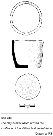
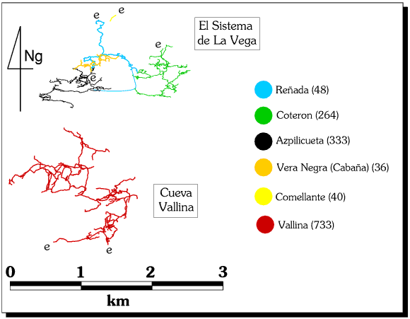
733 Cueva Vallina (Cueva Valline)
Arredondo Top entrance at VN5011(6)9262(1) Alt. 420m
Bottom entrance at VN5084(7)9257(4) Alt. 315m
Length 32954m (after October 2004) Depth 176m to low point in the downstream
sump
Updated 30th August 1998; 19th February 1999; 9th
January, 14th May 2000; 21st January, 23rd February , 5th May, 10th June,
16th October, 26th October 2001; 10th March, 6th May, 9th June, 11th November
2002; 24th January, 25th May, 18th October 2003; 7th January 2004; 3rd May,
13th June, 3rd July, 10th October, 6th November 2004; 30th July
2005
The top entrance lies hidden in trees
a short walk down from a rough road that sets off from the Arredondo-Alisas
road. The entrance is a 15m wide gash which would have been used for shelter
by people over the millennia and evidence of occupation has been found, both
flints and Bronze Age pottery. The discovery, deep inside the cave, of a
small, whole pot, possibly Bronze Age,
lead to the re-opening, after possibly thousands of years, of the second,
bottom entrance.
The cave was first extended from the top
entrance in 1989 by the British. The cave was then pushed in subsequent
years by the Tortosa group for another 3km to about 12km. In 1994, after
the downstream boulder choke was passed the previous year, some 7km of new
cave was entered in joint trips with the Spaniards. The length of 32575m
(after summer 2004) includes 3.5km of Tortosa finds in the early 90's which
are slowly being resurveyed and included.
Fifty metres into the 5m high cave the floor slopes down to a flat mud floor
halting progress at the limit of daylight., but a
draughting, excavated passage leads off
from the back wall. A flat-out squeeze (that may need bailing in wet weather)
and short crawl lead to the top of a 10m
pitch onto a steep slope down
to a cracked mud floor and white calcite flow. Where the passage turns to
head east, there is a tall, blind aven on the left. The passage continues,
10m wide and high, past some decaying
antlers, to a 4m climb down. The
route becomes larger over boulders and finally slopes down in a 20m wide
and 25m high chamber, choked at the far end at floor level. The right hand
wall consists of sand and boulders and a 23m climb up leads to a walk along
the right hand wall to a large roof tunnel and a
fine, bouldery veranda looking back down
into the chamber. This point is close (20m) to site
1823.
The tunnel continues as the Sunday Stomps for 250m passing some crystal
pools at the Glitter Run and emerging
into a chamber where the ways split. To the south,
the route skirts a pit and leads to
a muddy 25m pitch on a corner which was the original route to the lower levels.
The passage turns to the east and becomes the superb, sandy
Chunnel, 10m high and wide.
After 70m the floor rises to a wide, choked 15m deep pitch to the right while
straight ahead the route lowers to a short climb down through boulders to
a 30m pitch with a small, unexplored passage at the bottom. Just before this
pitch a climb leads into a large chamber where the draught is lost.
A crawl at the start of the Chunnel leads to a drop into a chamber with no
way out.
The usual route down into the middle of the cave lies near the Glitter
Run. The left hand passage at the split slopes down to the head of the
second pitch. Various bolt routes in avens all close down. The spacious second
pitch is split into drops of 12m and 18m and lands on boulders which slope
to the head of a 12m drop, passing under the 25m drop first used to enter
this series. At the base of the 12m drop, a small set of passages have been
pushed to chossy chokes and a strongly draughting choke after a climb down
in a rift. The main route continues as walking or stooping for 150m, following
an inward draught and finishes at a steep, sandy slope down into a tall chamber
with a possible bolt route to a passage in the roof. Before the sandy slope
a passage on the right leads to some chambers and passages with a climb down
on the left dropping into B-flat Passage which leads to the base of
the 3rd pitch. On the left, near the top of the sandy slope are some passages
with nice gypsum formations.
A climb up of 3m on the right hand wall immediately leads to the head of
the third, 13m pitch. There is a bolted climb to a choked passage above this
pitch. At the base, the routes split: a slot leads directly to the remainder
of the cave and will be described later; the wider route leads to the bottom
entrance.
A slope and climb down of 4m passes Windy Corner and becomes wider
at calcite. The passage continues in varied, comparatively small but easy
going, past a number of openings, until a bouldery area is reached. It was
at this point in the original explorations that a
small clay beaker was found. A crawl
and squeeze up over breakdown enters the bottom of an excavated 3m climb
to reach the surface at Lost Pot Entrance behind a large, slumped
section of hill side, about 100m lower than the altitude of the top entrance.
The above paragraph needs amplifying to bring in the Easter and summer
extensions between the 13m pitch and the bottom entrance.
The main route continues from the base of the third pitch, following a draught
through a slot beneath the ladder. A maze area is entered where perhaps not
all the passages have been surveyed or even explored. One route to the west,
first entered in 1996, leads into The Shopping Trip, which needs
describing. To the north, the maze holds the preferred route to the
Corkscrew climb, described later and ends at avens in a 10m wide,
boulder-floored chamber. At the beginning of this chamber, a short climb
through a horizontal slot to the west, below a wet inlet, enters a small
room with a high rift. An unprotected climb up gives access at two levels
to the top of a deep pitch which sounds large at the bottom. There are however
no obvious points for rigging and no sound rock for bolts. Further into the
chamber a climb down through boulders looks down into a narrow passage heading
back towards the high rift. The main way on lies to the east, where similar
passages in the maze lead south to the large, calcite and boulder-floored
Who Knows? chamber. Other routes also connect Who Knows? with
the maze at the 13m pitch and the whole area needs describing. At the eastern
side of the Maze area, heading to the northeast through Road to
Nowhere passage leads to a squeeze in sharp rock. A caver coming from
the top entrance might now have to put on an oversuit. (Passages in the roof
of Road to Nowhere were surveyed for about 100m at Easter 96). The
route then enlarges to The Canyon.
Through Barney Rubble's Uranium Mine to Galeria de Germán
In the Maze area, the first or fifth junctions on the left both lead
through complex areas of rifts and crawls into an area first explored by
the Catalans in about 1990-1991 and named by them L'Empedrat. This
was extended in 2003-2004. The two routes enter a passage about 5m square
in highly shattered rock, Shatter Passage. After a corner a chamber
containing rock pillars is passed. In this chamber, draughting sandy rifts
and crawls on the right are not fully explored, and to the left a small passage,
Centipede Crawl, joins the main route further on. The main route continues
after the chamber with odd sections of crawling. About 100m beyond the chamber,
small holes on the left lead a complex area with three routes leading off.
To the left is Tits Up, next, through a tight rift is Barney Rubble's
Uranium Mine, while to the right rejoins the main route at a 2m climb
down, mentioned below.
The main passage of L'Empedrat continues to a larger section where
the 2m climb comes in on the left. The way on is a climb up into a roof passage.
50m further on a slope up and drop back down is soon followed by a final
chamber with a draughting choke. A climb down on the left leads to a decorated
passage loops back, crossing a blind pitch in the floor.
Tits Up leads to a choke dug through at Easter 2004. Beyond, a passage
passes a draughting passage on the left, continuing small and heading towards
Pillar Chamber. Beyond is a 4m climb up into a wider passage, crossing
a short pitch and ending at a long-term dig after 76m.
Barney Rubble's Uranium Mine was entered at Easter 2004. It is about
250m long, largely crawling over sharp rock, with a tight section at the
start, and dug out in places following a fair draught. At the end larger,
unstable, passage is entered, choking after 7m to the right, and to the left
reaching a choke after 17m beyond. This was passed in the summer of 2004
on the right, entering a large chamber with pitches in the floor and left
hand wall (explored down a handline to a very tiny outlet at the bottom in
2005). A 40m handline is recommended for descent into and traverse round
the first part of the chamber.
At the far end of the chamber, the continuation is followed for 170m with
a pit traversed round on the left, and is followed by two 20m pitches which
have been descended. The first is reached by a steep slope down on the right,
and drops to a low passage blocked by a boulder one way and pushed to an
aven the other way. The second pitch is just beyond the first, in a slot
with a short vertical descent to boulders with an aven to the right, then
a steep slope down to a passage ending at avens and a 10m pitch to a short
bit of passage. At the bottom of the pitch/slope is an unexplored passage
over a pit on the left. A few metres beyond the two pitches, the main passage
ends at The Bridge of Khazad- Doom, overlooking a large passage,
Galeria de Germán. This cannot be reached directly as it is
cut through by a big hole taken by the second 20m pitch. It is reached by
crossing The Bridge of Khazad- Doom, followed by a 15m rope traverse,
The Traverse of the Pigs, and a 5m pitch down. The passage is followed
to an aven where a passage on the left reaches a larger passage, ending at
undescended shafts to the left and a chamber to the right. Galeria de
Germán continues along steep mud slopes requiring traverse lines,
and has been explored as far as a 6m handline climb to a lower level. This
has been explored as far as an aven chamber.
In October 2004 the far reaches of Galeria de Germán were extended.
The slimey climb at the end has blocks held in by glutinous clay and reaches
a bouldery chamber. Holes on the right connect to a parallel chamber; a hole
on the left leads to a canyon stream and a 9m pitch and aven. Straight on
from the climb reaches a stream trench and to the left leads to a meandering
passage with white sand banks - Dark Angel Desert that chokes after
a small chamber. Back on the left, there is a 10m undescended pitch.
To the right at the stream trench, descorated passage is reached - Mollusc
Magic - and a passage that parallels the route in. A pitch at the end drops
into muddy narrow rifts with possible crawls to be pushed.
The pitch marked "?p15" at the traverse and turned out to be 19m deep.
In the summer of 2005 most leads were pushed to a conclusion - the results
are very "bitty" and have yet to be tied in with the descriptions above.
The notes from the log book follow:
Pitch at the end of the stream trench, 30ft into small chamber
with body-sized crawl leading to an impassable meander.
Body-sized tube on left at end of dry passage led to continuation of passage
(low bedding) becoming too low over calcite floor.
Slope up a side rift at start of Mollusc Magic went to more small passage,
slippy climbs up at end of M.M. also went nowhere.
Everything else went nowhere - bottom of Sala German; bottom of pit in first
chamber.
The remaining leads are a passage on the left at the base of the pitch by
the Bridge of Khazad Doom; tight rifts in the first chamber.
... and should be compared with notes from Patrick Warren:
All leads to W of the rope climb at end of Galeria de German were
pushed to conclusions.
To S of Dark Angel Desert, two crawls are accessible and open out on opposite
sides of a ~ 3m climb, with a further ~ 4m drop to the base where there is
an impassable outlet (a rope is essential to return up the last ~ 4m drop).
Underneath Dark Angel Desert, a vadose trench can be followed to a ~ 10m
pitch, descendable (just) as a rope climb. From the bottom, ~ 10m of sideways
thrutching in the base of a narrow rift leads to a point where it is possible
to turn around. Beyond here, violent meanders in the body-sized canyon passage
halted progress. Thus far, the streamway appears to be following below the
line of the main passage.
N of Dark Angel Desert, a passage leading W becomes definitively too low
beyond a tight tube. N again (Mollusc Magic), the muddy climbs were explored
to conclusions. To E, there is a tall rift partly filled with large fallen
muddy blocks, but no way on was found.
In summary, apart from the vadose canyon trench below the 10m pitch which
a very determined small caver might push, there are no remaining leads in
this part of the cave.
The first pit encountered on entering the extensions after leaving Barney
Rubble was descended as a rope climb. This is the one before the *original*
'bridge' of Khazad-dum. It was ~ 12m deep - the first 6m on a suprisingly
stable boulder slope, and the last 6m vertical. An impenetrable fissure was
the only passage leading off the base. It's worth noting that this means
the pit is apparently unconnected with Pringle's black space visible through
gaps in the main passage wall at the top and far side of this pit.
The whole series was detackled after the "final" exploration.
A scan of the 2005 notes on the Galería de Germán survey is
found here.
To the right of the Maze Area, and before the Hole in the Wall,
on the right of the passage is a 12m pitch, descended in 1996, down to a
short passage into the narrow Haymarket Stream Passage. During easter
2003, a pitch in the Haymarket Series was descended for 8m to a tight mud
tube and a too tight rift. A boulder choke above was looked at with a possible
tight climb up in blocks. At Easter 1998 another pitch was explored in the
Maze Area with the Catalans, but was unsurveyed.
Passage opposite Hole in Wall was explored in 2003 for about 30m to
a choke and an aven.
Going through the Hole in the Wall leads to a steep slope down and
pitch up to a mud traverse to a low chamber with the way on in the right
hand corner. This route is not recommended and the corkscrew climb should
be approached via the first major easterly junction in the previous maze
area. A small tunnel with a calcite floor follows the draught to a 6m corkscrew
climb or easy 10m pitch. A tight squeeze leads to a split level route, in
the water or above, following the draught. After passing an oxbow on the
right a junction is met and a climb down. Downstream, another junction is
soon met: downstream, the passage develops a trench in the floor of a wider
passage, but eventually becomes low. A low duck leads to 50m of wet crawling
to a possible sump, while a short inlet becomes too tight; upstream the passage
joins The Canyon. A high level, narrow traverse leads to an aven.
Above the aven is 50m of passage, blocked by stal. The floor rises to meet
the traverse and easy walking pops out into the base of The Canyon.
At the junction climb-down, the upstream route enters a narrow passage with
pools. After some 250m, where the passage trends east and passes under Who
Knows? chamber, a shelf above the stream is followed, passing inlets
of the left and right. An inlet on the right is a muddy crawl which leads
to a gradually enlarging passage, not pushed to any conclusion. After a corner
two further avens are passed and a stal constriction is reached. A 10m flat
out tube leads to the bottom of a very loose climb through boulders in a
narrow rift. A 30m by 10m chamber is reached and the left hand wall followed
to drop down in an awkward climb to a spot where two passages have not been
looked at. A shuffling passage widens to walking and a large, low chamber
to the east which has not been pushed. (There are also other possibilities
for pushing in this area). The route on follows the draught in the roof to
a 44m long chamber, only 2m high with an "egg shell" floor. In the far corner
is a tight squeeze and contortions into a passage which climbs up through
a bouldery floor. On the right is an easy crawl which has yet to be pushed.
Following the draught from the chamber leads directly to the Lost Pot
Entrance.
At Who Knows chamber, the ramp on the right has been climbed up through
boulders to about 60m of well decorated passage with several draughting avens
in a passage called Where Who Knows Goes. In this vicinity Walrus
Passage is a side passage linking to the main route in three places,
partly surveyed, and which also links up ramp to passage to Who Knows.
At The Canyon, cut by a stream crossing the passage at right angles
a tight and sharp climb down leads to a step over a short drop to the stream.
A muddy climb up on the opposite side reaches the continuation of the passage.
The passage is again of reasonable size, walking with the occasional squeeze.
After 80m the way splits, the northern route passes an undescended pit and
then narrows to emerge in a 10m wide passage. The eastern route, the Clapham
Bypass is easier going but emerges in the same passage at a group of
pleasant formations. Routes at the top of the decorated slope have not been
pushed to a conclusion, but there is not much scope for extension.
An aven just after The Canyon was dug through stal in 2003 to an aven
and muddy, draughting inlets that became too tight.
Chambers to the south of the Clapham Bypass - Road to Glory
junction were pushed in 2003 through stal into a chamber with a dig
through stal into a further chamber with a good draught.
The passage to the north of the Clapham Bypass continues up to 15m
wide and 10m high in the sandy-floored Roads to Glory. On the right
of this passage a slope leads to 5m and 6m pitches to immature streamways,
which may have been descended. To the north, the passage splits, the right
hand branch lowers to a crawl and finishes in a low, bouldery chamber where
voice contact can be made with explorers in the bigger passage beyond. The
walking-sized left hand branch gradually enlarges to an impressive junction
after some 60m.
To the right the route becomes 20m wide and meets a boulder slope with a
crawl at floor level under boulders to a dig. Above, the slope rises to the
east to a large, draughting boulder choke, which was declared a major project
at Easter 2001. A northern branch slopes down to a 12m climb up, where a
ladder is needed. The passage (La Pita) leads after some 50m to an
undescended pitch (above the avens in the lower stream passage). After another
fifty metres at high level, a passage sets off on the left to a climb and
choke, surveyed in 2003.
To the left the passage has a superb flat roof and sandy floor which enters
Swirl Chamber at the base of a large boulder slope. Swirl Chamber
is approximately 40m in diameter and rises up on loose boulders to three
passages at the western side. The northern tunnel ends at a choke after 50m,
the middle line continues uned after 50m and the southern one continues for
120m to an unexplored pitch. On the southern edge of Swirl Chamber,
a small passage enters an unsurveyed section containing a large, undescended
pitch and a route heads back to link with the flat roofed tunnel, joining
it half way along.
The Climb on the Big Junction Series was entered at Easter 2001 by
climbing up a steep slope to reach a climb down into the base of a drippy
aven. The inlet involves loose climbs, low crawls, and short walking rifts
into an aven series. Climbing up 8m leads to another short length of cave
ending at avens with choked rifts leading out.
The only route through to the rest of the cave lies to the north at the base
of the boulders cascading out of Swirl Chamber. A short walk over
boulders emerges at the five way FN Junction. The large boulder slope to
the left chokes. Six Hundred Pesetas Passage is entered on the opposite
side of the junction. This passes crawls on the right after 20m and passes
a 30m pitch (apparently explored by the Catalans) where it turns to the west.
Two side passages on the north side were looked at in the summer of 1999.
The first crawl on the right after the pitch leads to a junction after some
50m. The next junction enters a small passage that ended at a 22m pitch that
was too tight at the base.
Albert's Grand Passage and beyond
During the summer 2002, a climb of 40m up and around a calcited wall in FN
Passage enters Albert's Grand Passage and Skyhook Passage.
This continues (bolted in November 2002) beyond a deep pitch which has been
explored and closes in. (Description of the series required). In 2003, a
bolt route around the pitch was tackled into the draughting, continuing passage
to a T-junction and holes down.
This was pushed and surveyed as Broken Tooth Passage at Easter 2004.
On the far right side of the aven, a small window can be entered. Climbing
down leads to several blind pits with stream dribbling above. Squeezing to
left yields a window to another aven pitch 10-15m (not descended) Water/(stream)
can be heard at bottom, probably that dripping in.
Crossing the main pitch leads to small muddy passage (to the left of that
described above). After a short flat out crawl, easier progress is made with
some good decoration. A small break down chamber is reached. Continuing on,
a very well decorated chamber is reached. Left leads to a wide section of
passage, but blocked by calcite flow at the end. A passage on the left leads
back to the breakdown chamber. All other passages/climbs on the left are
blind.
On the right hand wall a very tight rift (needs hiltiing) drops to a floor
3m down with possible passage. No other leads. To the right leads to a 6m
pitch. Over the top of the pitch, climbing up the calcite flow, a possible
chamber/aven can be seen through calcite, possibly draughting. This would
require some work to remove calcite.
From the base of the pitch, several holes and a chamber 4m off floor to the
right, are all blind. Asending the muddy slope leads to a collapse. A passage
at the base of the collapse, to the left leads under the collapse with stream
dribbling in from it - blind, no draught. Climbing the collapse yields a
break down chamber with several short passages, all blocked. Draught does
head through this collapse area.
Leads:
1 - Swing into window to undescended 2nd aven. Possible rift heading off,
but hard to tell. Not believed that base of 2nd aven deeper than 1st aven.
Water flows out into 1st aven directly below swing in window. Probably same
water as in 2nd aven.
2 - Possible aven over 6m pitch, but difficult to tell. A lot of work to
gain access, but may yield by pass to collapse.
3 - Tight rift in large passage. Needs hiltiing - Not thought worthwhile
Six Hundred Pesetas Passage becomes floored with calcite and then
sand, and ends after 350m from FN Junction at a boulder choke. Just
to the south of Six Hundred Pesetas Passage lies the entry to a small
tunnel which passes a 4m drop after 50m and leads to the 9m deep Tuesday
Pitch. At the pitch base a small passage continues low and nasty upstream
while downstream it leads after 100m to the Rioja River. This is also
entered via Dutch Pitch, described later.
The FN Passage to the east of FN Junction is 20m wide and 10m
high but appears to be just a small segment of a longer passage as it lowers
and closes down after only 150m. There is an unexplored pitch and dig at
the end of this passage. On the left hand side of FN Passage, after it has
turned north, the Catalan Climbs series starts. A c34 up reaches further
slopes up and a narrow vadose passage. A climb up mud and boulders has not
been attempted.
Further along FN Passage, November Passage leads off on the right.
This rises to Amazing Stal Chamber with good formations and calcite
runs, choking after 125m.
Where FN Passage swings north, two exits lead off on the right wall.
One is entered via a slope down and after some 60m this route ends at a boulder
choke, an unsurveyed chamber and an undescended pitch. The higher passages
lie at the top of a climb up the left hand wall and across a blind pit. The
right hand route leads to The Dutch Circle where a loop contains
formations, boulders and a 20m undescended pitch. The left hand route (in
a small vertical maze) leads to a 4m pitch followed by the 31m deep Double
Dutch Pitch, the normal entry point to the lower streamways.
At the base of the pitch, a small muddy streamway is met. The upstream route
ends at an aven after 150m, while downstream the small passage becomes a
4-way junction at the Rioja River. A tiny inlet (Shit Inlet)
was entered at Easter 2002 and goes for 25m. The main passage upstream sumps
after some 120m, after passing an inlet on the left which enters boulders
where a link to the main stream goes off to the right.
The upstream sump was dived in August 1996 by Rupert Skorupka. Sump 1 (Lady
Beatrice's Underwater Fantasy) was delightfully clean and surfaced after
21m into more streamway. Within 40m sump 2 was reached and passed after 47m.
This sump had underwater flowers of calcite on the walls, and a skin of calcite
on the surface that was duly smashed from below. 176m of pleasant streamway
was then explored to sump 3, another inviting, unexplored dip. During the
wet and cold Easter of '98, pushing the sump was continued by Ross Greenwood
and Martyn Holroyd. Sump 3 was dived to small chamber at -2m with the way
on being down a gravel slope into a comfortable sized continuation. The sump
continues NNE, dropping to -6m then rising steadily up a large silt bank,
then again dropping to -6m. After 50m, the main tunnel appears to rise up
a rift with a parallel rift also rising to -1m without surfacing.
During the same trip, a passage was noticed on the northern side of sump
2 and this was followed in large passage along doglegs, but generally heading
north. This is obviously the main route on and exploration stopped at the
end of the line at -6m and 50m in. Exploration continued during Easter 2000
when the sump was extended by 100m and 130m over 2 trips. About 280m from
base, the passage surfaces in a narrow, miserable canal for some 10m. The
passage then sumps again and was pushed at Easter 2001 for another 200m mainly
through rifts and over silt banks and still heading NNW. The way on continues
in similar fashion. (A survey of the sumps is found
here).
The easy downstream Rioja River passage continues for about 700m.
The passage starts with standing water and after 250m meets the inlet from
the Tuesday Pitch. The water then heads off to the north along the
small Where the Rioja Goes, unsurveyed to a sump. A dry continuation
of the passage gets larger to the west and after 50m meets another stream
flowing from the south - the Rioja Reserva. This stream passage is
of impressive dimensions for most of its 400m length. It ends where the water
wells up through a choked area. A short crawl to the north enters a number
of avens.
Downstream, the Rioja Reserva continues west to meet a sump. (The
size of this stream is similar to the stream which disappears in Where
the Rioja Goes, although the latter does not appear to join the Rioja
Reserva streamway). The sump has a short bypass via an awkward climb
up a steep tube where a rope is useful and the stream passage continues and
enlarges for another 100m to end, after a complex boulder area, with a sump
and small inlet passage. The water (in dry weather flow) has been dye tested
but detectors in Cueva Molino (791) at an altitude
of 200m and Cueva del Comellantes (040) with an entrance
altitude of 170m proved negative after 2 weeks.
The summer of 1993 saw a joint Spanish / British trip to look at the downstream
sump which was dived by PP. The dive took about 45 minutes and the diver
turned round at the start of sump 3 after some 120m. There is 20m walking
between sumps 1 and 2 and an airbell between sumps 2 and 3.
(The following downstream sump description needs matching with
the drawn-up survey).
At Easter 2002, Martin Holroyd extended Phil Papard's downstream dive to
give 644m of surveyed passage through 5 sumps with about 500m of above water
passage. Sump1 is soon passed into a fine passage with a choke running in
on the right. The next inviting sump is an easy swim surfacing at a spike.
Sump 3 was new this year and is a large, blue sump gently dipping down a
gravel slope before gently rising to surface. Sump 4 was passed, similar
to the last into open passage. A wonderful stream passage follows, up to
15m high. Two inlets and a possible climb up mud are passed, before finally
turning a sharp corner and another large sump.
This was entered on a following trip. After 60m the sump enlarges and drops
off below to the right. To the left, a steep ramp rises up. This reaches
air space giving a sump 5 length of 110m. The exit is up a difficult mud
slope. A large, very muddy inlet can be followed upstream through massive
mudbanks, evidence of substantial backing-up. The inlet becomes smaller with
awkward climbs up mud slopes. The solo explorer gave up where it was necessary
to crawl and squeeze at a junction. The left hand branch was draughting
strongly.
In the summer of 2003, a further 110m of line was laid downstream. The route
descended to -22m and has now gradually risen to -17m where it is seen to
continue.
A route through the boulders at the original downstream sump leads to a small
passage heading west and a tight section where a strong draught encourages
digging (see below).
Individuals of Nemastoma were collected in the area of the top of
the first pitch.
By August 1991 the Tortosa group appear to have extended the cave to some
12km long.
Bolting was also started at the upstream end of the lower levels and this
is still proceeding.
The draughting boulder choke was also inspected and on a later, British-only
trip (with permission), the boulders were passed through an
awkward squeeze into a chamber. A passage
on the left is choked with mud and boulders after about 90m. Most of the
draught in this section disappears in the roof through small holes, one of
which has been followed for about 50m via very small, awkward meanders to
a tight squeeze through which water can be heard.
Beyond the chamber a stream is entered; upstream and crawling over boulders
on the right leads to a large chamber (end of '93 extension). The main extensions
occurred during 1994, with additions during 1995.
A low, muddy passage leads to a climb down over boulders into a main stream
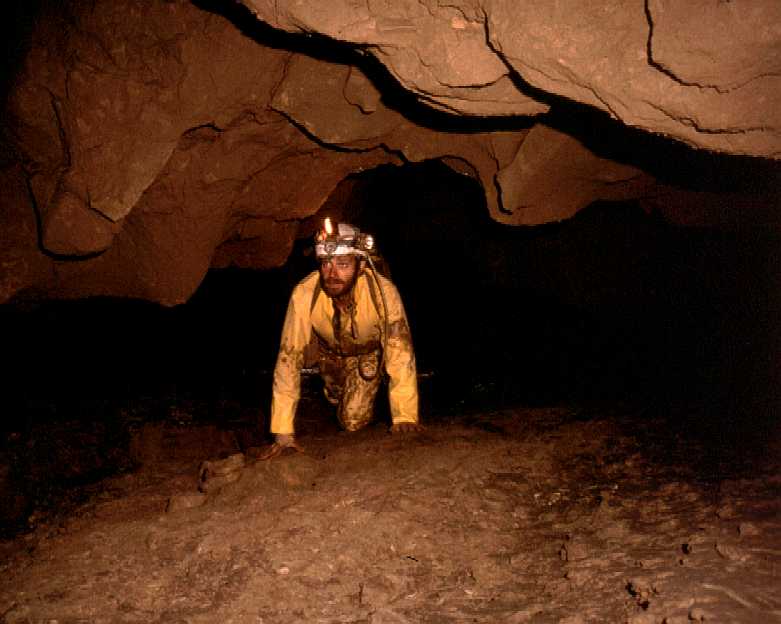
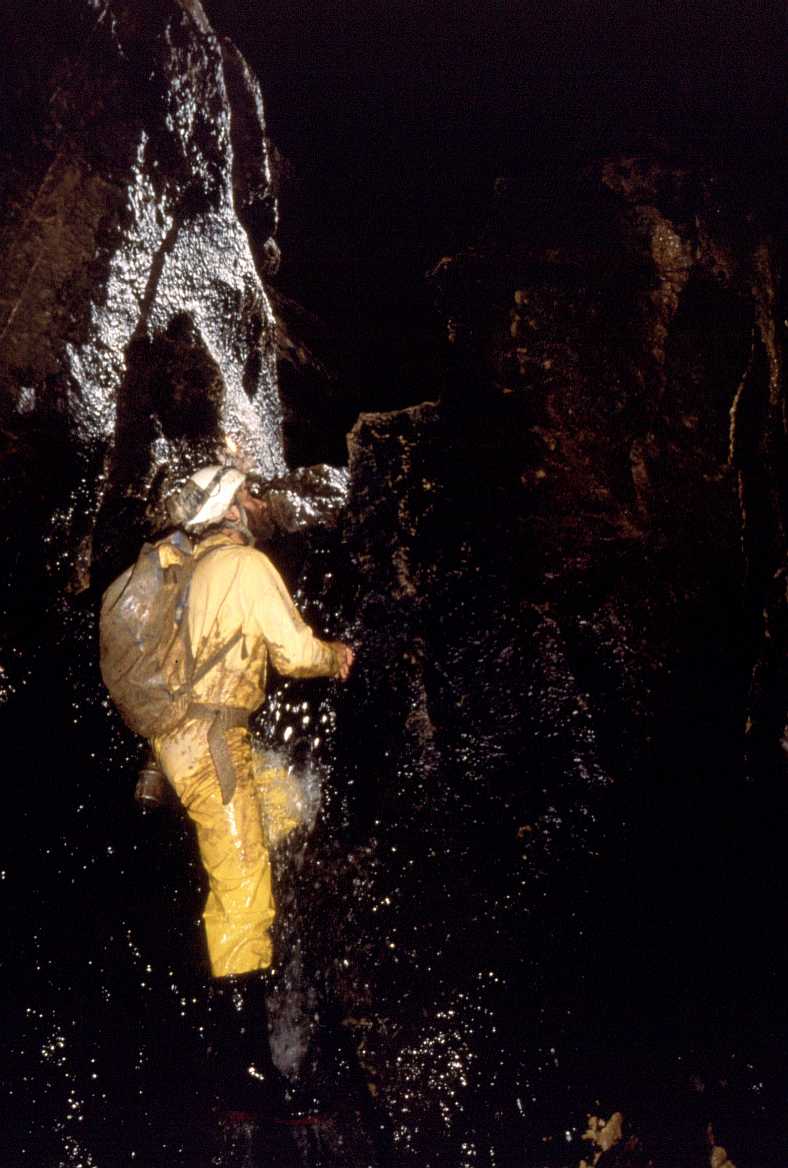
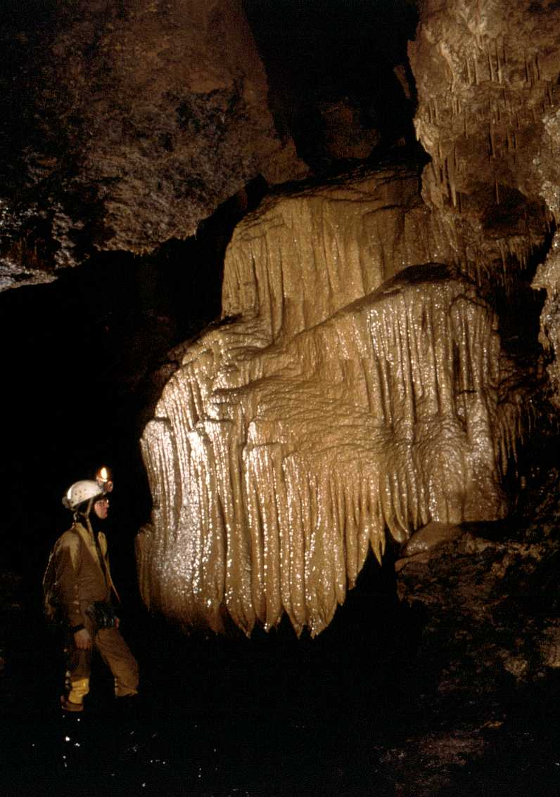
passage, the Rio Grande, explored upstream for about 1.6km, (Pictures
1
2
3 4
) mainly in fine, large passage. After 300m, an inlet on the right,
Río Blanco, has been surveyed for over 1km, mostly walking-size,
passing a 20m diameter aven chamber, the Novadome. Several leads remain.
Just before a canal section in the main stream, some 300m further upstream,
Waterfall Inlet has been explored up an awkward 4m cascade climb followed
by a 12m wet bolt climb in an active aven after 120m. At the top is dry passage
and a continuing upstream passage to twin avens, one taking the stream. The
Passage That Turned to Jelly leads off on the left to enter the
Novadome, 20m up.
The next inlet, Simeon's Loop, has been explored to a climb up into
a higher level fossil passage. Left leads to a continuation to the cascades
in the main stream and a connection back to the inlet passage. On the right
(Not Simeon's Loop) is a fossil passage, passing a bolt climb to possible
higher passage, not yet completed, and eventually invaded by the inlet, ending
in a waterfall chamber with the stream beyond coming from an aven of about
10m, not climbed. At the chamber, a steep climb over mud formations enters
large fossil passage. To the right a route involving awkward climbs of 6,
5 and 6m connects to Rio Blanco upstream of the Novadome; to
the left passes a pit then well decorated bouldery passage, ending at a huge
pit. the First Abyss, above Thornton Force. A traverse to the
right reaches the continuation of the main fossil passage, the Galeria
de los Elefantes, and a route left leads to a view point above Thornton
Force.
In 2003, an unsurveyed passage running south from the west side of the First
Abyss was entered. This is 4-6m wide, 1 - 4m high and very well decorated,
ending at a diggable choke with a small draught and some skeletons.
Back in the main streamway, a boulder choke is passed, then Quicksand
Passage on the left - entered for 20m and draughting. Beyond are climbable
cascades below the connection to the previous inlet. A large chamber follows
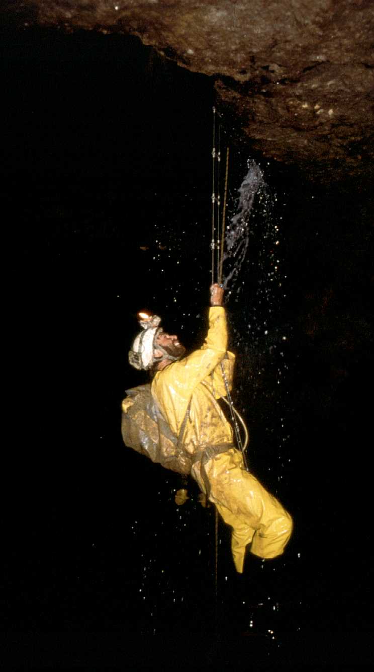
with a 5m pitch up beside the water
(Thornton Force). This was left
rigged in 1993 but by 2003 the rope had been destroyed by floods.
Above the pitch, a number of slippery cascades need a rope or combined tactics.
After 400m upstream, a roof passage enters a high level series of large,
very well decorated passages, explored for 1.3km. The first section, Crystal
River Passage, leads to a huge pit, the First Abyss, where a 30m
climb down reaches the floor. A descent over boulders leads to a slot which
may provide a pitch down into Thornton Force chamber. A slippery,
exposed climb up the opposite wall leads to continuing large passage, the
Galeria de los Elefantes, explored to the Second Abyss.
Several side passages lead off on the right of Galeria de los Elefantes.
First is Frog Passage, mostly crawling, which ends at the twin avens
reached from Waterfall Inlet. Part way along is a frog (?) skeleton.
Next are two passages which join and reach a complex area explored by the
Espeleo Club Tortosa. On the left, Els Penitens connects to the big
aven in Toc Gallery. Last, is a passage leading through several maze
areas (not totally pushed) ending at a climb at a draughting choke which
may be easily passed. This passage runs parallel with the main passage leading
to the Second Abyss.
Boxhead Traverse runs around the right hand side of the Second
Abyss, which drops about 50m to a choked outlet at the bottom. A continuation
of the large passage soon closes down, but a climb up through a narrow, loose
rift on the left hand side eventually gains a large chamber. After a number
of huge blocks have been negotiated, a 5m pitch at the back of the chamber
soon chokes after a few metres of passage. There appear to be some phreatic
tubes present part way down the Second Abyss but would require a bolt
route to enter.
A small opening in the left hand side of Galeria de los Elefantes,
just beyond the First Abyss, leads to Helictite Maze, where
there appears to be many ways through. Beyond a section of helictites, a
junction floored with limestone pinnacles is reached. To the left the passage
rejoins the Crystal River passage going west, that enters the other
side of the First Abyss. (This provides an easy alternative to ascending
the far wall of the First Abyss. To the right, the passage degenerates
into a crawl, Cobra Passage, joins an abandoned stream canyon. Upstream
leads to a calcite choke, downstream to an aven and continuing unpushed passage.
During the summer of 1995 the western streamway was pushed. An obvious inlet
on the left hand side may be followed into a low passage which eventually
enters a chamber. An abandoned route also enters the chamber from further
upstream as well. Several small streams cascade down a massive choke which
has been partly explored but no route through has been found. Continuing
upstream in the main passage, the roof lowers until a crawl meets an area
of collapse. One route has been pushed which enters an aven, choking after
a series of climbs (about 15m). Part way up, a small tube to a grotto can
be squeezed past and a tight right continues northwards - Crumble Passage.
This has not been pushed to a conclusion.
Toc Gallery is a long stream passage entered by climbing up a slope on the
right at the start of the Rio Grande crawling over gours and descending a
mud slope to drop into the walking-sized stream passage. Beyond the Hale
Bopp Trail and the Rope Climb Series, Toc Gallery continues past a huge aven
to a choke where handline climbs up and down regain the streamway. The September
1994 extensions - Galeria New York City - lie at the end of Toc Gallery and
need a description. A trip in 1998 found that the draught in was lost near
the end up a 10m aven where a hole is crossed in the floor.
Further extensions at Whit 95 need the survey data entering and a description.
(J. Palmer).
At Easter 97, the Hale Bopp Trail was entered off Toc Gallery.
This sets off about 80m upstream as a small inlet entering from the right
hand side. The Hale Bopp Trail starts as a tight meandering streamway
containing a noticeable draught. At 40m, along a dug calcite squeeze in water
marks slightly easier going and, after an attractive orange-yellow calcite
floor, a short climb up marks a change in character. The rift becomes very
awkward and then suddenly enters through the floor of a large, high chamber
running north-south. A slippery climb up at the northern end leads to a small
passage and large calcite formation. A climb at the southern end, where the
inlet water falls from the roof, eventually leads to a junction: straight
ahead chokes but a hole on the right hand side gains several small
interconnecting chambers. From here, a small canyon passage carrying a strong
draught leads to a calcite blockage which may be dug. (Catalans 13/8/97?)
In 1998, a passage to the north of Hale Bopp, the Rope Climb
Series was entered. After a muddy climb on the right, about 160m of muddy
rift passages were surveyed ending at a tight, draughting climb up which
is worth returning to. A branch on the left ends in the roof of Toc
Gallery. There is also a possibility on the other side of Toc
Gallery which will require a bolt to reach.
In the same year, the Catalans climbed up 15m at the start of the chamber
north of the Maze Area (713,334) and enter the Resistance Gallery
- an inlet which ends at two avens.
References: anon., 1989 (logbook); Neill A et al, 1989; Corrin
J, 1990 (survey and photo); Corrin J, 1992a (survey); Corrin J, 1992b (survey);
anon., 1991 (logbook); anon., 1993b (logbook); material in file; Corrin J,
1994a; anon., 1994b (logbook); Corrin J, 1994b (survey); Muñoz
Fernández E and Malpelo García B, 1995; anon., 1995b (Whit
logbook); anon., 1995c (logbook); Corrin Juan, 1995a (photo); anon., 1996a
(Easter logbook); anon., 1996b (logbook); Corrin Juan, 1997a (survey); Corrin
Juan, 1997b; anon., 1997a (Easter logbook); anon., 1997b (logbook); Corrin
Juan, 1998; anon., 1998a (Easter logbook); anon., 1998d (logbook);
Fernández Ortega F, Valls Uriol and Maria del Carmen, 1998 (photo);
García José León, 1997 (survey and photo); Algueró,
A, Martinez, C and Garcia, A, 1998 (survey and photo); Corrin Juan, 1997c;
Corrin Juan, 1999; anon., 1999c (logbook); Corrin Juan, 2000; anon., 2000b
(Easter logbook); Corrin Juan, 2001; anon., 2001a (Easter logbook); anon.,
2001b (Whit logbook); Corrin Juan, 2001a; anon., 2002a (Easter logbook);
anon., 2002b (summer logbook); anon., 2002c (autumn logbook); anon., 2002d
(Christmas logbook); Corrin Juan, 2003a; anon., 2003b (Easter logbook); Corrin
Juan, 2003b; anon., 2003c (summer logbook); Ruiz Cobo Jesús and Smith
Peter, 2003; Corrin Juan, 2003c; anon., 2003e (Christmas logbook); anon.,
2004b (Easter logbook); anon., 2004c (Whit logbook); anon., 2004d (summer
logbook); anon., 2004e (Autumn logbook); anon., 2005b (Easter & summer
logbook)
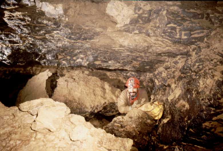
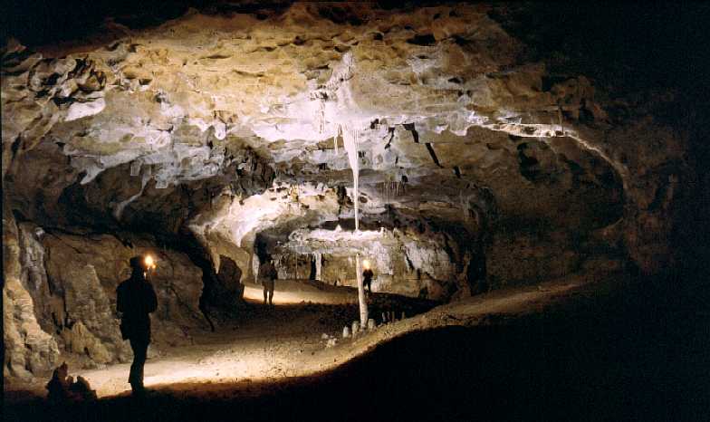
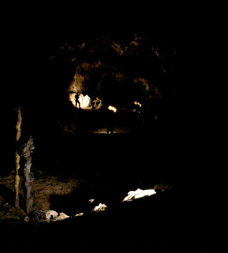
Entrance picture : bottom entrance
1 2
top entrance 1
2
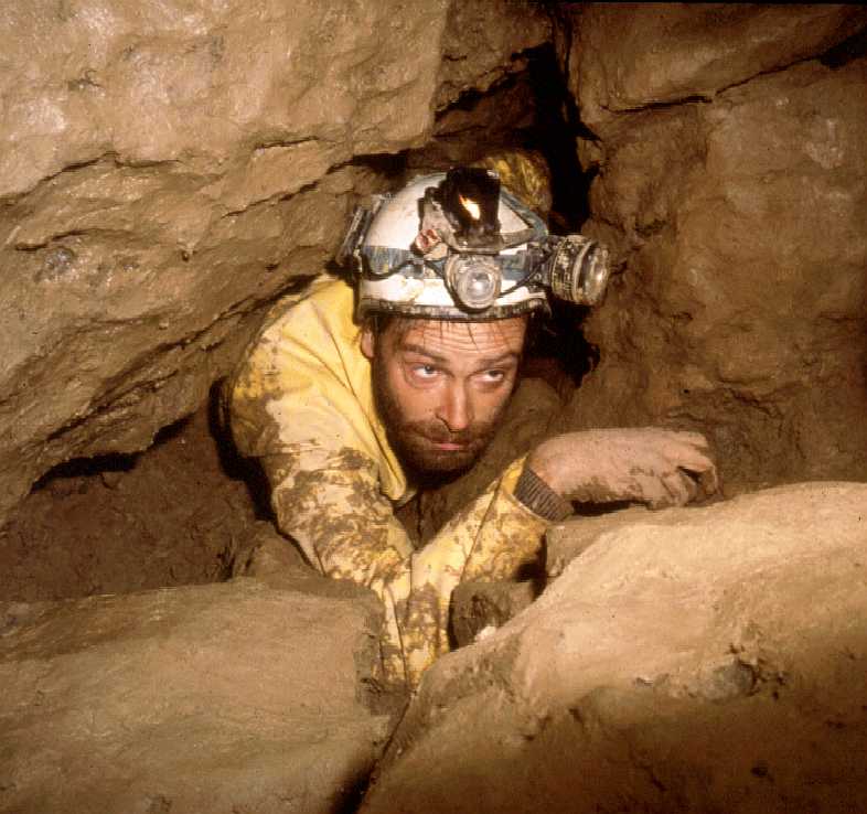
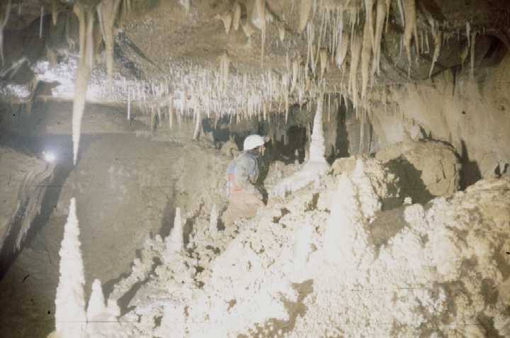
Underground picture(s): entrance
passage? entrance crawl
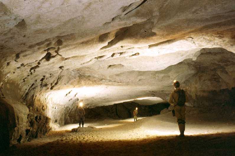
Glitter Run
streamway 1
2
3
4
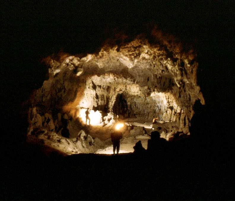
boulder connection
Thornton Force
17 pictures from October
2004 in Barney Rubble and beyond to the white sand
28 pictures from summer 2004
in Barney Rubble towards Galería de Germán
Digital photos by Juan Corrin of
mud formations near Swirl Chamber |
 |
 |
Digital photos of the route from Swirl Chamber to
the lower entrance by Peter Eagan (2001).
Click to enlarge. |
 |
 |
 |
 |
 |
 |
 |
 |
 |
 |
 |
 |
 |
 |
 |
 |
 |
 |
 |
 |
 |
 |
 |
 |
 |
 |
 |
 |
 |
 |
 |
 |
 |
 |
Videos : Lost Pot
Entrance (1.8Mb) formations
around FN Passage (4.6Mb)
Phil Papard at The Canyon (2.8Mb)
narrow entrance passages
(2.2Mb)
entrance passages (1.8Mb)
formations (2.3Mb)
formations
(2.8Mb)
Detailed Survey : Martin Holroyd's
Easter 2001 dive with earlier dives
(scan of hand-drawn survey).
Notes: This relates to the Corel Draw Vallina survey drawn by Ali
Neill. The Opera browser displays all of the survey one-sheet files
below. Internet Explorer appears to only display the smallest.
Right-clicking on any link and selecting Save Target As ... will save
the file and allow it to be opened in any graphics application.
end of 2004 - large (450kb gif - one
sheet)
end of 2004 - smaller (300k gif
- one sheet)
end of 2004 - smallest (100k gif
- one sheet)
This pdf file is a 1.1Mb file of 9
sheets. Again, right-clicking as Save Target As... will keep the
file for future use.
A download of
Adobe Acrobat
reader is required. This would appear to be the best way of sharing the
survey.
Line Survey :
yes-2003
On area survey : Relationship to the
South Vega System (from the 90's)
Survex file : download
download Vallina with the
South Vega System


