
Lancaster hydrometric & water quality stations
East of Llyn Brianne reservoir: LI3, LI6, LI7 & LI8 stream stationsLive 15-min updated data (NOTE all times in GMT) at the Esgair Garn weather station Brianne stations within the SMART watershed network
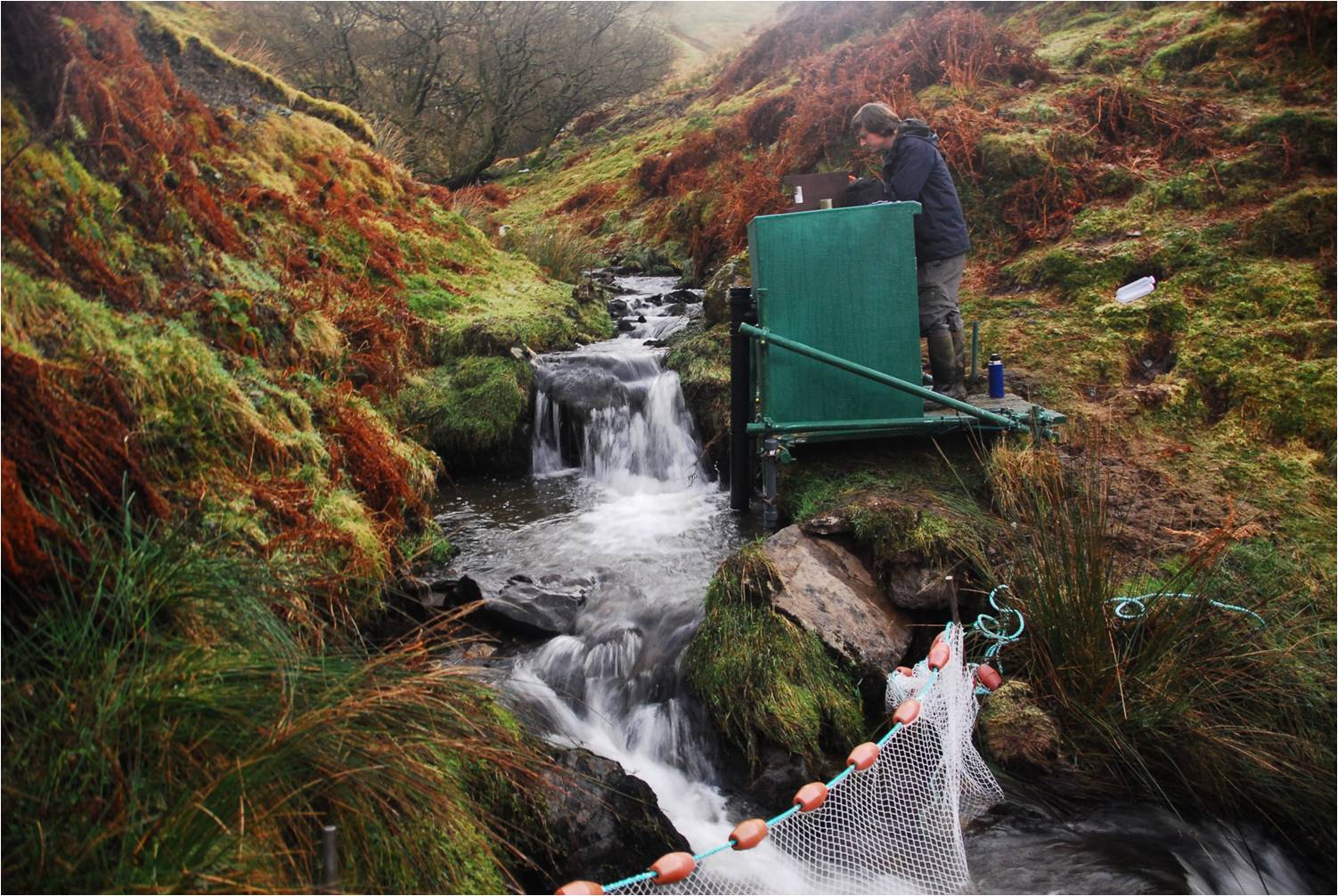
Monitoring water quality at the LI7 (Nant Rhesfa) water quality station © NA Chappell
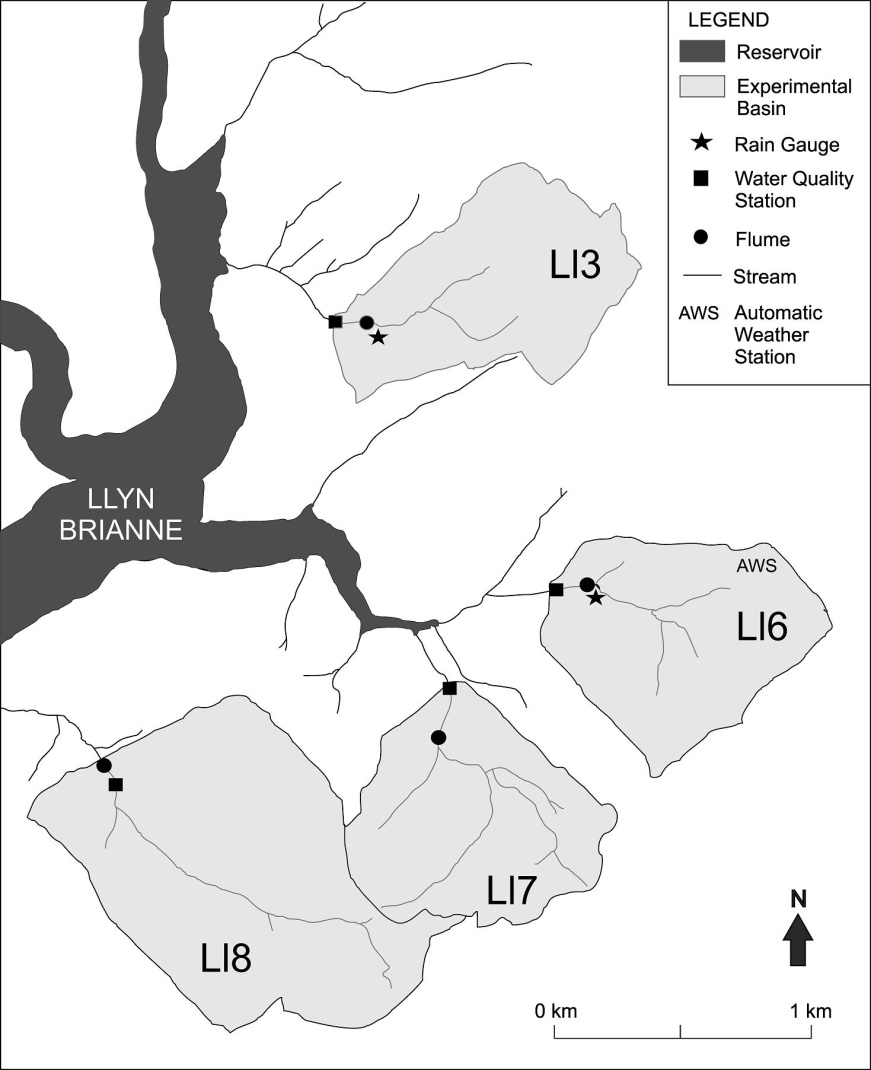
Locations of Lancaster streamflow and water quality monitoring stations near Llyn Brianne © TD Jones
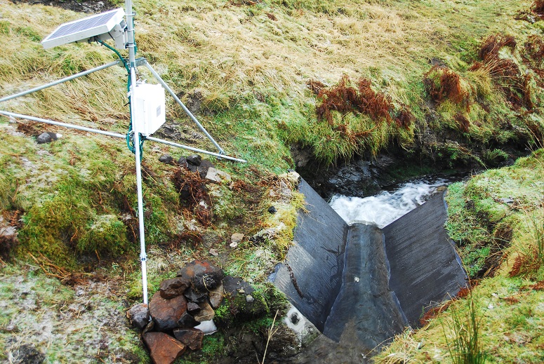
Lancaster flume for gauging streamflow in the LI7 (Nant Rhesfa) basin © NA Chappell
Lancaster University gratefuly acknowledge the permissions given by local landowners to access the monitoring sites nr Llyn Brianne and will respect their assets, stock and activities. Please contact Dr Nick A Chappell via n.chappell@lancaster.ac.uk or tel: 01524 593933 if any issues arise with the Lancaster water quality stations ("green boxes"), trapezoidal flumes or weather station.
CEH hydrometric & water quality stations
Focus on the Lower Hafren & Gwy flumes plus associated weather stations- see CEH Plynlimon Catchments

Gwy flume & DURESS water quality station, Plynlimon © NA Chappell
DURESS macro-basins
River WyeDURESS regional scale
Upland Wales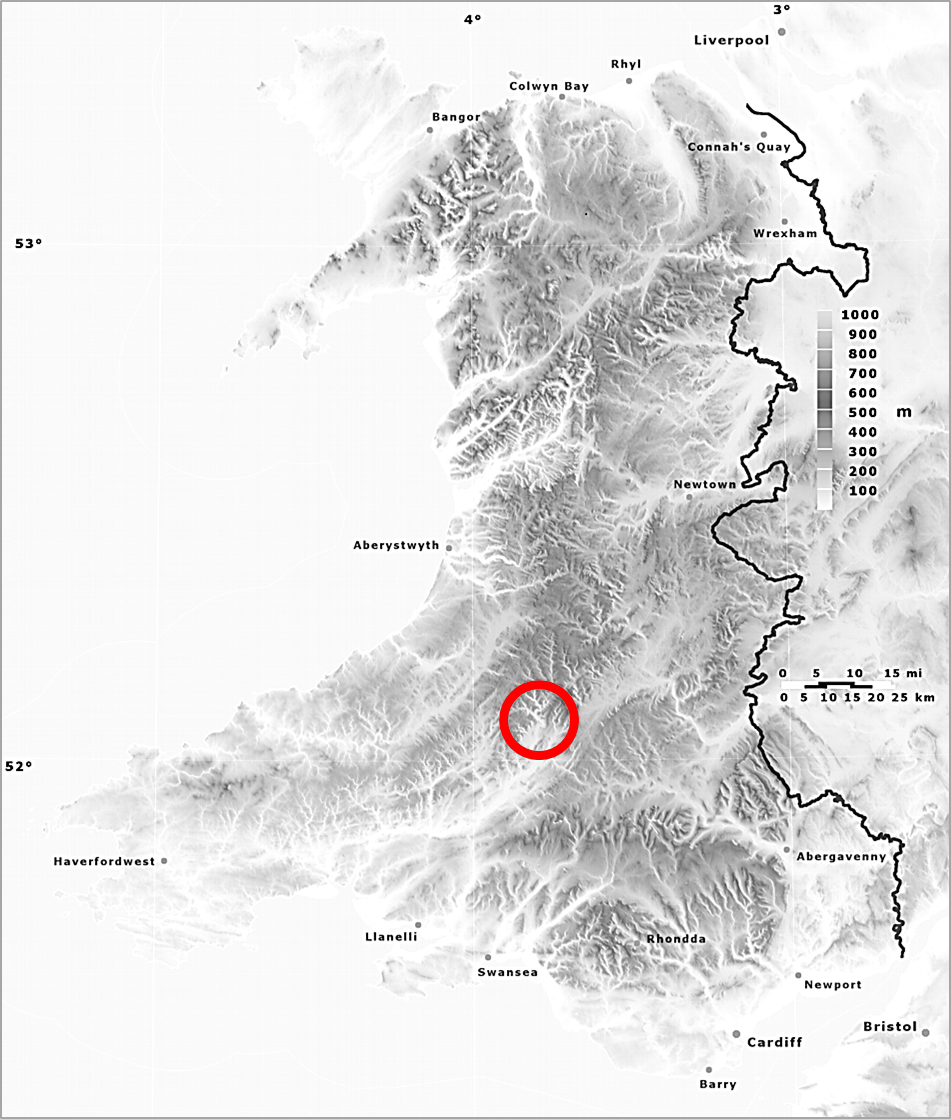
Topogaphical map showing the extent of upland Wales and location of the Lancaster hydrometric & water quality monitoring
stations near Llyn Brianne on the headwaters of Towy River