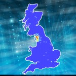
One of the benefits of working with GIS is that, in allowing the user to visualise the geography underlying a complex set of data, it helps one more effectively to detect spatial patterns and relationships in that data.
In the field of historical epidemiology, for example, GIS has proven to be extremely useful for studying the outbreak and spread of past epidemics, and thus for tracing trends in disease and mortality.
Recently, however, researches have begun to apply GIS to study other kinds of geographical phenomena, including literary and artistic representations of specific places and landscapes. Between 2007 and 2008, for example, members of our project team, along with Prof Sally Bushell (in the Dept. of English & Creative Writing), conducted a pilot study to test the interpretive possibilities of using GIS to map out historical accounts of the English Lake District.
The Lake District is an ideal focus for a study that uses GIS because it’s a region that has long been portrayed in poems, guidebooks and paintings. One thinks of Wordsworth, West and Turner, of course, but one can also think of an array of writers and artists (from Celia Fiennes and Daniel Defoe to Alfred Wainwright and the Abraham Brothers) who have shaped our perception of Lakeland and its landscapes. The study our team conducted five years ago sought to show how GIS technology could help researchers analyse the accounts of historical Lake District tourists and explore how representations of the region have changed over time. This study focused on two famous accounts of the English Lake District: Thomas Gray’s epistolary journal of his tour of 1769 and the letters and notes Samuel Taylor Coleridge composed during his ramble through the western fells in 1802.
 Our current research seeks to go beyond this pilot study by creating a fully geo-referenced digital corpus to analyse the development of the Lake District as a cultural landscape between the early-seventeenth and early-twentieth centuries.
To date, this corpus consists of 80 digitized texts, comprising well over 1,500,000 words and spanning from the 1622 edition of Michael Drayton’s Poly-Olbion to the twenty-second edition of Black’s Shilling Guide to the English Lakes, which was published in 1900. The full list of texts includes a number of well-known works, such as the guidebooks of Lakeland luminaries like William Wordsworth and Harriet Martineau. Importantly, however, it also features the works of dozens of lesser-known writers, including Priscilla Wakefield, W. G. Collingwood and the Lancashire dialect poet Edwin Waugh.
This mixture of sources is significant, because one of the main benefits of working with large corpora of historical books and manuscripts is that it allows us to generate more historically nuanced interpretations. By situating canonical texts, such as Wordsworth’s Guide, alongside popular tourist publications, such as Black’s Shilling Guide, we can perform far more comprehensive analyses of how the Lake District was perceived, experienced and represented in the past.
In order to facilitate these analyses, we’ve also begun to develop exploratory mapping tools and techniques. This past December, for example, we completed a case study using GIS-based approaches to create more accurate representations of the routes travelled and described by Gray and two other famous eighteenth-century Lake District tourists: Arthur Young, who paid a visit to the Lakes on his Six Months’ Tour of Northern England in 1768, and Thomas Pennant, who passed through the region during his two tours to Scotland in 1769 and 1772. To learn more about this study, please click here.
