
Task 4. What are the flood mitigation benefits of NFM from feature-scales to large catchment scales in Cumbria?
This is the core task of the whole Q-NFM project. Here we combine the acceptable models of observed river discharge records with shifts in the model parameters based on our Task 1 NFM evidence base, and with a range of spatially-distributed NFM scenarios set by Task 5.
Specific tasks:
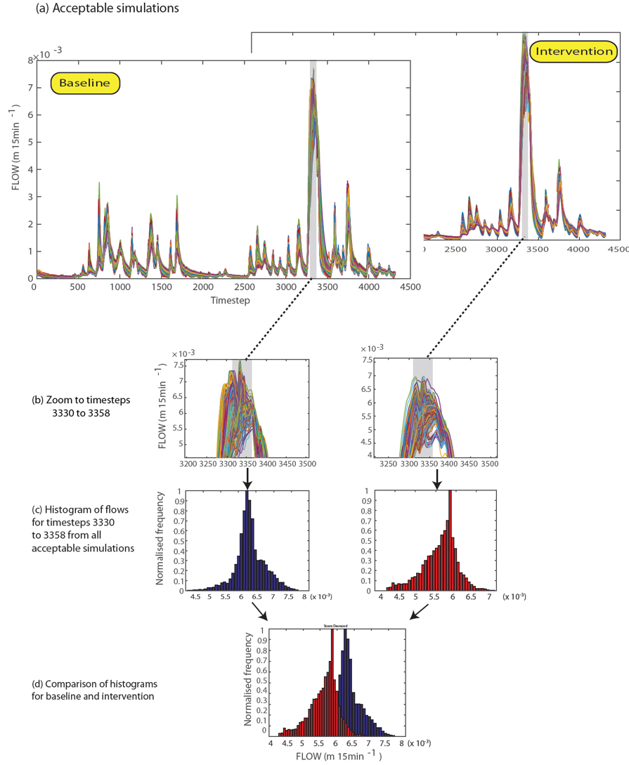
In the NFM modelling we simulated NFM effects on the acceptable model ensembles from Task 3 by utilising a combination of CCD data (Task 1), the plot-pair and micro-basin data (Task 2), and the NFM Extent Map Sets from Task 5. Typically we assumed that NFM features were operating at optimum performance; reductions in performance and failure of NFM interventions were explored in Task 6. The modified parameter sets were used to re-simulate the historic sequences of flood-events across the Cumbrian-basins (Task 3) and project micro-basins. As these parameter shifts are inherently uncertain, multiple weighted-scenarios of change were simulated for some interventions, notably the tree planting scenarios (see e.g., Q-NFM Finale presentation).
An example of this NFM modelling is shown for the intervention of 'Enhanced Hillslope Storage' in the 200 sq km Kent Catchment (Beven et al., 2022 e14752)