THE DECM PROJECT
How can language technologies and geospatial analysis facilitate answering important questions about the early colonisation of America? How did the Spanish colonial authorities portray and use information about the newly conquered territories and people? Can we identify, map, and analyse the geographies associated with the colonial period of Mexico, and what was said about them in historical sources, through expedite computational means?
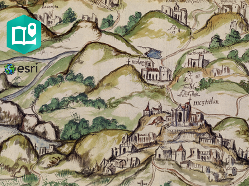
Using part of the corpus known as Relaciones Geográficas de la Nueva España – one of the most important colonial historical sources of America – concerned with the territory of Mexico, this project is creating and developing novel computational approaches for the semi-automated exploration of thousands of pages contained in these 16th century documents.
Tackling important historical and methodological questions, and highly demanding challenges in the study of these written sources, we are extracting, analysing, and visualising information that can improve our understanding of this period, and expedite the process by which we study these documents.
Our highly interdisciplinary team is combining techniques from different disciplines, including Corpus Linguistics, Text Mining, Natural Language Processing, Machine Learning, and Geographic Information Systems, to address questions related to the recording of information about indigenous cultures, the Spanish exploration of indigenous social and religious concepts, the appropriation and ideas about place and space in the indigenous world, and their attitudes towards politics and economy.
OUR AIMS
To analyse colonial history like never before.
LATEST NEWS
Our past matters
Pathways to understanding 16th century Mesoamerica
Two of our team members, Raquel Liceras-Garrido and Katherine Bellamy have recently completed the project ‘Pathways to understanding 16th century Mesoamerican geographies’, funded by the Lancaster University Department of History. This spin-off project
Subaltern Recogito: Annotating the sixteenth-century maps of the Geographic Reports of New Spain
We're very pleased to have been awarded a Pelagios Commons Resource Development Grant to explore the annotation of
Workshop – Exploring AI for Humanities Research
The week before last, we organised a two-day workshop, ‘Exploring Artificial Intelligence for Humanities Research’, hosted by the
DECM at the Spatial Humanities Conference
A couple of weeks ago, the 2018 Spatial Humanities Conference was held at Lancaster University (20th—21st September). This