This section is under development.
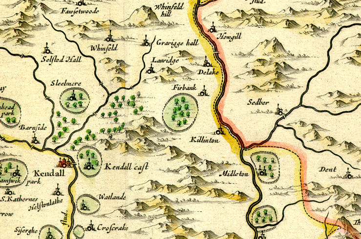
Johannes Blaeu (Amsterdam, c.1648), from the Theatrum Orbis Terrarum sive Atlas Novus. Vol. IV:
England and Wales :
Detail from the County of Westmoreland
Based on Saxton's 1579 map. N.b. no roads are shown: the dotted line is a county boundary. Bridges however are drawn across the rivers. Some of the names have been misread: Natland appears as ‘Watlande’, and Sled[dale] as ‘Sleel[mere]’.
Image © Meg Twycross 2008