|
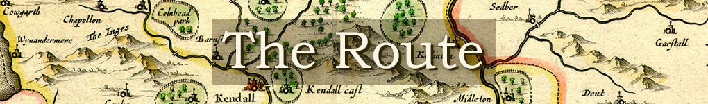
There are several kinds of cartographical evidence we can call on to plot Fox’s route and make it possible for us to follow in real time and space: The great era of English map-making begins in 1579 with the publication of Christopher Saxton’s Atlas of the Counties of England and Wales. Saxton’s maps were adapted by
Camden’s Britannia (1607) and John Speed’s The theatre of the empire of Great Britaine (1611). All these maps are based on counties. There was one detailed continuous set of the whole
of England, Wales, and Southern Scotland, produced in 1644, called the Quartermaster’s Map because it was intended to be ‘Vsefull for all Commanders for Quarteringe of Souldiers,
& all sorts of Persons, that would be informed, Where the Armies be’; in other words, like the original Ordnance Survey, it was primarily for military purposes. There were no others of the kind,
except for very small scale ones of the whole kingdom, until John Cary in 1794. A different genre is the road map, which like the old Automobile Association personalised maps, concentrates on the routes, orienting the traveller with a compass rose, and showing side roads, landmarks, and the type of terrain, hills to be surmounted and rivers to be crossed. John Ogilby published his Britannia in 1675: the routes he shows would have been familiar to Fox, though Fox also moved off the main roads. An invaluable resource for the area is the magisterial Old Cumbria Gazetteer by Martin and Jean Norgate. © All the early maps used in this website, unless otherwise acknowledged, are owned by Meg Twycross and the images are her copyright. Modern (largely Electronic) Maps (Plotting the Route) The facilities provided by Google Maps™ allow us to customise their satellite images to show not only where Fox's contacts lived, but the routes he probably took. These can be enlarged
to show minute detail, and accessed independently from your Notepad or smartphone to act as a travel guide. See Plotting the Route in the menu-bar. Ordnance survey maps are available online at https://explore.osmaps.com/.
This site provides all the detail of the earlier printed maps, and allows you to go in to individual house level, both mapped and in satellite view. There is also a 3D feature, available on subscription. The Next Stage The next stage of the project will use various techniques in GIS mapping to layer information about terrain, routes, clusters of Friends and Seekers, and centres of interest (markets, churches and chapels, prisons, safe houses, Quaker ‘pulpits’, &c) onto modern maps. 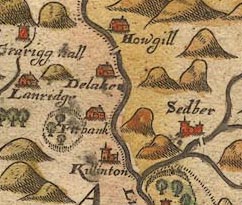 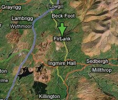 The left-hand map (Saxton 1579) showns the same terrain as the right-hand map (Google satellite view). 1. The exception is William Smith’s one-off Map of Surrey (1602), which shows main roads with a double dotted line. Single dotted lines are however parish boundaries; the dotted lines on county maps are county boundaries. Unfortunately Smith did not complete his projected series of county maps, because Speed pre-empted him. Return |