

Map 1
 Anti-Idyll
 Castle
 Distortion
 Encounter
 Idyll
Idyll Metalepsis
 Parlour
 Public Square
 Road
Road Threshold
 Provincial Town
 Wilderness
 Direct
 Indirect
 Interrupt
 Jump
Jump Projection
 Metatextual
 Paratextual
 Intratextual
Map 2

Map 3
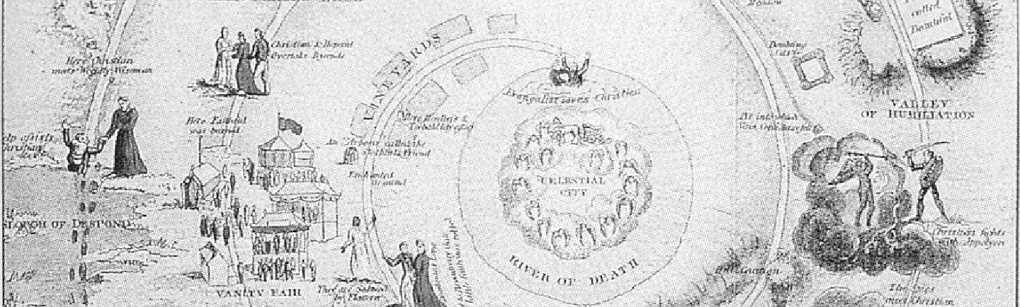
Strip Map (1788)
The map used as a referential layer here appears to be the earliest map of Pilgrim’s Progress (presumably made to celebrate its publication one hundred years earlier in 1668). It takes the form of a strip map – a new popular way of representing routes in the late eighteenth century that proves highly appropriate for what is essentially a road-narrative. The map is read from bottom to top and left to right across three columns. These divide the route into three sections: from the 'City of Destruction' to the 'Valley of Humiliation'; from the 'Valley of the Shadow of Death' to 'Doubting Castle'; from the 'Delectable Mountains' to the gates of the 'Celestial City'. A colour version of this map was also made in 1780 and reproduced multiple times.
The tools used to make these visualisations are available on Github at
https://github.com/chronotopic-cartographies/visualisation-generators.