

General Enquiries
If you would like to make a general departmental enquiry, please visit our Contact and Find Us page.
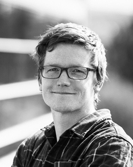
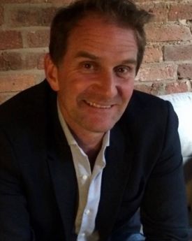
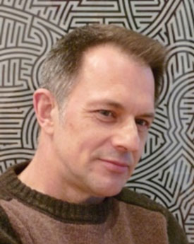
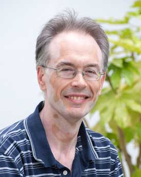
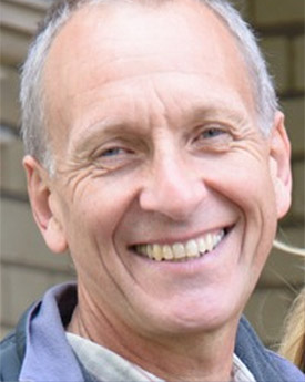
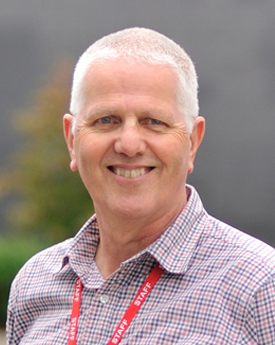
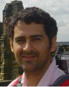
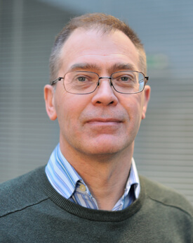
Director
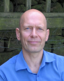
Professor Crispin Halsall
Director of LEC, ProfessorAtmosphere, Climate and Pollution, Centre for Global Eco-innovation , Environmental Science, Improving global stewardship, Innovation for a better environment, Understanding a changing planet
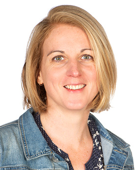
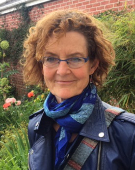
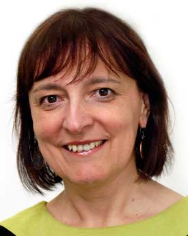
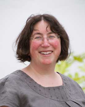
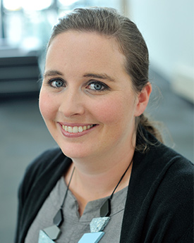
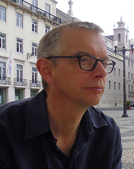
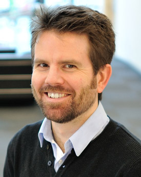
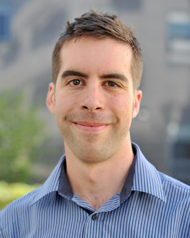
Deputy Directors
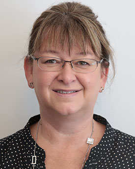
Dr Ruth Alcock
Head of Enterprise & Business Partnerships
enable JavaScript to view email address
A14, A - Floor, LEC 3
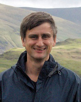
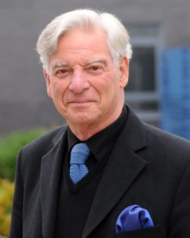
Dr Ben Surridge
Senior LecturerCentre for Global Eco-innovation , Environmental Science, Innovation for a better environment, Sustainable Catchments, Understanding a changing planet
Departmental Administrator
Bitten Brigham
Departmental Administrator
enable JavaScript to view email address
+44 (0)1524 510288
-
All Staff and Postgraduate Researchers
- Selected letter: All
- U
- X
Loading People
We couldn't find anybody who matched your criteria
Energy Lancaster, Human Geography
enable JavaScript to view email address A14, A - Floor, LEC 3Ecology and Conservation
Human Geography, Pentland Centre
enable JavaScript to view email address A29, A - Floor, LEC 3Earth Science
Plant and Crop Science
enable JavaScript to view email address B47, B - Floor, LEC 3Centre for Sustainable Soils, Centre of Excellence in Environmental Data Science, Energy and Environment, Energy Lancaster, Environmental Science, Pentland Centre, Soil Plant and Land Systems
Plant and Crop Science
Centre for Sustainable Soils, Centre of Excellence in Environmental Data Science, DSAIL- Environment, Earth Science, Geospatial Data Science, Lancaster Intelligent, Robotic and Autonomous Systems Centre, LIRA - Environmental Modelling, LIRA - Fundamentals, STOR-i Centre for Doctoral Training
Centre of Excellence in Environmental Data Science, Environmental Science
Centre for Sustainable Soils, Centre of Excellence in Environmental Data Science, Ecology and Conservation
enable JavaScript to view email address +44 (0)1524 594856Centre for Sustainable Soils
Earth Science, Environmental and Biogeochemistry, Improving global stewardship, Innovation for a better environment, Sustainable Catchments, Understanding a changing planet
African Studies Group, Ecology and Conservation, Improving global stewardship, Latin America Research Cluster, Understanding a changing planet
enable JavaScript to view email address B48, B - Floor, LEC 3Plant and Crop Science
enable JavaScript to view email address A014a, A - Floor, LEC 1Centre of Excellence in Environmental Data Science, Ecology and Conservation
enable JavaScript to view email address A50, A - Floor, LEC 3Human Geography, Political Ecology of Agrarian Transitions
Centre for Sustainable Soils, Ecology and Conservation
enable JavaScript to view email address +44 (0)1524 522155Atmosphere, Climate and Pollution, Institute for Social Futures Fellow
CeMoRe - Centre for Mobilities Research, Critical Geographies, Human Geography, Improving global stewardship, Politics in the Climate Crisis, Understanding a changing planet
enable JavaScript to view email address A531, A - Floor, LEC 1 & 2Centre for Global Eco-innovation , Centre of Excellence in Environmental Data Science, Sustainable Catchments, Understanding a changing planet, Water Science
enable JavaScript to view email address +44 (0)1524 848766Centre of Excellence in Environmental Data Science, DSAIL- Environment, Earth Science, Energy Lancaster, Innovation for a better environment, Sustainable Catchments, Understanding a changing planet, Water Science
enable JavaScript to view email address B539, B - Floor, LEC 1 & 2Centre of Excellence in Environmental Data Science, Ecology and Conservation
Centre of Excellence in Environmental Data Science, Environmental Science
Centre of Excellence in Environmental Data Science, Environmental Science
enable JavaScript to view email address +44 (0)1524 510288Centre of Excellence in Environmental Data Science, Ecology and Conservation, Geospatial Data Science
Human Geography, Political Ecology , Political Ecology of Agrarian Transitions
Plant and Crop Science
enable JavaScript to view email address B057, B - Floor, LEC 1Human Geography, Political Ecology of Agrarian Transitions
Human Geography, Political Ecology
Plant and Crop Science
Environmental Science, Improving global stewardship, Innovation for a better environment, Sustainable Catchments, Understanding a changing planet, Water Science
Centre of Excellence in Environmental Data Science, Environmental Science
Human Geography, Improving global stewardship, Political Ecology
enable JavaScript to view email address A30, A - Floor, LEC lllCentre of Excellence in Environmental Data Science, Ecology and Conservation
Critical Geographies, Energy Lancaster, Human Geography, Improving global stewardship, Politics in the Climate Crisis, Understanding a changing planet
enable JavaScript to view email address A29, A - Floor, LEC 3Human Geography, Political Ecology
enable JavaScript to view email address B506, B - Floor, LEC 1Centre of Excellence in Environmental Data Science, Environmental Science
enable JavaScript to view email address +44 (0)1524 521996Earth Science
enable JavaScript to view email address A532a, A - Floor, LEC 1Energy Lancaster, Human Geography
Centre for Global Eco-innovation
Centre for Sustainable Soils, Centre of Excellence in Environmental Data Science, Environmental Science, Improving global stewardship, Soil Plant and Land Systems, Sustainable Catchments, Understanding a changing planet
Ecology and Conservation
Centre of Excellence in Environmental Data Science, Ecology and Conservation
Centre of Excellence in Environmental Data Science, Ecology and Conservation
enable JavaScript to view email address A53, A - Floor, LEC 3Centre for Global Eco-innovation , Centre for Sustainable Soils, Improving global stewardship, Morecambe Bay Curriculum, Plant and Crop Science
Centre of Excellence in Environmental Data Science, Ecology and Conservation
Centre of Excellence in Environmental Data Science, Ecology and Conservation
enable JavaScript to view email address B49, B - Floor, LEC 3Human Geography
enable JavaScript to view email address +44 (0)7846 900597Ecology and Conservation
Earth Science, Environmental Science
enable JavaScript to view email address +44 (0)1524 510082Centre of Excellence in Environmental Data Science, Ecology and Conservation
enable JavaScript to view email address B066, B - Floor, LEC 1Centre of Excellence in Environmental Data Science, Earth Science, Energy Lancaster, Improving global stewardship, Sustainable Catchments, Understanding a changing planet, Water Science
enable JavaScript to view email address B509, B - Floor, LEC 1Improving global stewardship, Innovation for a better environment
Human Geography, Improving global stewardship, Innovation for a better environment, Political Ecology , Political Ecology of Agrarian Transitions, Understanding a changing planet
Centre of Excellence in Environmental Data Science, Ecology and Conservation
Environmental Science
enable JavaScript to view email address +49 (0)179 6931140Earth Science, Innovation for a better environment, Understanding a changing planet
enable JavaScript to view email address B523c, B - Floor, LEC 1 & 2Plant and Crop Science
Critical Geographies, Energy and Society, Energy Lancaster, Human Geography
enable JavaScript to view email address A28, A - Floor, LEC 3Human Geography
enable JavaScript to view email address A23, A - Floor, LEC 3Centre of Excellence in Environmental Data Science, Ecology and Conservation
enable JavaScript to view email address B048, B - Floor, LEC 1Ecology and Conservation
Energy Lancaster, Environmental and Biogeochemistry, Environmental Science
enable JavaScript to view email address B521c, B - Floor, LEC 1Environmental Science
enable JavaScript to view email address +44 (0)1524 522179Atmosphere, Climate and Pollution, Centre for Global Eco-innovation , Environmental Science, Improving global stewardship, Innovation for a better environment, Understanding a changing planet
Plant and Crop Science
Centre for Global Eco-innovation , Centre for Sustainable Soils, Energy Lancaster, Environmental and Biogeochemistry, Environmental Science, Sustainable Catchments, Water Science
Environmental and Biogeochemistry, Improving global stewardship, Sustainable Catchments
Human Geography, Political Ecology of Agrarian Transitions
Plant and Crop Science
Human Geography, Political Ecology of Agrarian Transitions
enable JavaScript to view email address B503, B - Floor, LEC 1Atmosphere, Climate and Pollution, Environmental and Biogeochemistry, Improving global stewardship, Understanding a changing planet
Human Geography, Pentland Centre, Political Ecology
Centre for Sustainable Soils, Earth Science, SCC (Communication Systems)
enable JavaScript to view email address +44 (0)1524 593410Atmosphere, Climate and Pollution, Centre of Excellence in Environmental Data Science, DSAIL- Environment, Environmental Science
Environmental Science
enable JavaScript to view email address +44 (0)7593 813990Earth Science
enable JavaScript to view email address +44 (0)1524 522257Centre for Global Eco-innovation , DSAIL- Environment, Earth Science, Energy and Environment, Energy Lancaster, Innovation for a better environment, Morecambe Bay Curriculum, Sustainable Catchments, Understanding a changing planet, Water Science
enable JavaScript to view email address +44 (0)1524 522044Ecology and Conservation
enable JavaScript to view email address A24, A - Floor, LEC 3Centre of Excellence in Environmental Data Science, DSAIL- Environment, Earth Science, Lancaster Intelligent, Robotic and Autonomous Systems Centre, LIRA - Environmental Modelling, Understanding a changing planet
enable JavaScript to view email address B522a, B - Floor, LEC 1Centre of Excellence in Environmental Data Science, Ecology and Conservation
Centre for Biophotonics, Environmental and Biogeochemistry, Environmental Science, Improving global stewardship, Innovation for a better environment, Sustainable Catchments, Understanding a changing planet
enable JavaScript to view email address +44 (0)1524 522330Ecology and Conservation
enable JavaScript to view email address +44 (0)7798 710025Centre for Sustainable Soils, Earth Science
Environmental Science
enable JavaScript to view email address B511, B - Floor, LEC 1Centre for Sustainable Soils, Centre of Excellence in Environmental Data Science, DSAIL- Environment, Ecology and Conservation
enable JavaScript to view email address A25, A - Floor, LEC 3Ecology and Conservation
enable JavaScript to view email address +44 (0)1524 522082Centre for Sustainable Soils, DSAIL- Environment, Extreme Value Theory, Morecambe Bay Curriculum, Security Lancaster, Sustainable Catchments, Water Science
enable JavaScript to view email address +44 (0)7866 715761Centre of Excellence in Environmental Data Science, Ecology and Conservation, Pentland Centre
Earth Science, Innovation for a better environment
enable JavaScript to view email address B522b, B - Floor, LEC 1 & 2enable JavaScript to view email address B48, B - Floor, LEC 3Ecology and Conservation
Centre of Excellence in Environmental Data Science, DSAIL- Environment, Environmental Science, Geospatial Data Science
enable JavaScript to view email address +44 (0)1524 594387enable JavaScript to view email address +44 (0)1524 522326enable JavaScript to view email address A31, A - Floor, LEC 3Human Geography
Plant and Crop Science
enable JavaScript to view email address B043, B - Floor, LEC 1Centre of Excellence in Environmental Data Science, Environmental Science
enable JavaScript to view email address +44 (0)7763 528285Centre for Biophotonics, Innovation for a better environment, Sustainable Catchments, Understanding a changing planet
Centre of Excellence in Environmental Data Science
enable JavaScript to view email address A532, A - Floor, LEC 1Violence and Society UNESCO Centre
Critical Geographies, Energy Lancaster, Human Geography, Innovation for a better environment, Politics in the Climate Crisis
enable JavaScript to view email address B26, B - Floor, LEC lllenable JavaScript to view email address +44 (0)7976 301919Centre of Excellence in Environmental Data Science, Environmental Science
Ecology and Conservation
Centre for Global Eco-innovation , Improving global stewardship, Innovation for a better environment, Plant and Crop Science
enable JavaScript to view email address B065, B - Floor, LEC 1 & 2enable JavaScript to view email address +44 (0)7790 984189Centre of Excellence in Environmental Data Science, DSAIL- Environment, Environmental Science, Geospatial Data Science
enable JavaScript to view email address +44 (0)1524 592595enable JavaScript to view email address +44 (0)7932 198002Ecology and Conservation, Improving global stewardship, Understanding a changing planet
Ecology and Conservation
Centre for Sustainable Soils, Environmental Science, Sustainable Catchments
Centre of Excellence in Environmental Data Science, Energy Lancaster, Environmental Science
Earth Science
enable JavaScript to view email address A511, A - Floor, LEC 1Environmental Science, Sustainable Catchments
Centre for Sustainable Soils
Centre of Excellence in Environmental Data Science, Environmental Science, Space and Planetary Physics
enable JavaScript to view email address A524, A - Floor, LEC 1enable JavaScript to view email address A17, A - Floor, LEC 3Earth Science, Understanding a changing planet
enable JavaScript to view email address +44 (0)1524 593898enable JavaScript to view email address +44 (0)7740 597389Centre for Sustainable Soils, Plant and Crop Science
Morecambe Bay Curriculum
Plant and Crop Science
Earth Science
Centre of Excellence in Environmental Data Science, Earth Science
Plant and Crop Science
enable JavaScript to view email address B47, B - Floor, LEC 3Centre of Excellence in Environmental Data Science, DSAIL - Health, Human Geography, Improving global stewardship, Political Ecology , Understanding a changing planet
enable JavaScript to view email address A528, A - Floor, LEC 1Centre for Scholarship and Innovation in Management Education, Energy Lancaster, Environmental and Biogeochemistry, Environmental Science, Innovation for a better environment, Sustainable Catchments, Understanding a changing planet
Centre for Global Eco-innovation , Improving global stewardship, Innovation for a better environment
enable JavaScript to view email address +44 (0)7311 154407Human Geography, Political Ecology
enable JavaScript to view email address +44 (0)1524 595043enable JavaScript to view email address +44 (0)1524 592362Centre of Excellence in Environmental Data Science, Environmental Science
Centre for Sustainable Soils, Environmental Science
enable JavaScript to view email address +44 (0)1524 521958enable JavaScript to view email address +44 (0)1524 241397CeMoRe - Centre for Mobilities Research, Energy Lancaster, Mobilities.Lab
enable JavaScript to view email address +44 (0)1524 811606enable JavaScript to view email address A53, A - Floor, LEC lllCentre of Excellence in Environmental Data Science, Environmental Science, Improving global stewardship, Innovation for a better environment, Soil Plant and Land Systems, Sustainable Catchments, Understanding a changing planet
Plant and Crop Science
Ecology and Conservation
Improving global stewardship, Innovation for a better environment, Plant and Crop Science
enable JavaScript to view email address B33, B - Floor, LEC 3Plant and Crop Science
enable JavaScript to view email address B47, B - Floor, LEC 3Centre of Excellence in Environmental Data Science, Ecology and Conservation
enable JavaScript to view email address B23, B - Floor, LEC 3Earth Science
enable JavaScript to view email address +44 (0)7749 770852Earth Science, Ecology and Conservation, Sustainable Catchments
enable JavaScript to view email address +44 (0)1524 521991Ecology and Conservation, Plant and Crop Science
Human Geography, Innovation for a better environment, Political Ecology , Sustainable Catchments, Understanding a changing planet
enable JavaScript to view email address +44 (0)1524 593897Centre for Sustainable Soils, Environmental Science
enable JavaScript to view email address +86 (0)186 9226 3026Centre for Sustainable Soils, Centre of Excellence in Environmental Data Science, Earth Science, Ecology and Conservation
Centre for Sustainable Soils
Centre for Global Eco-innovation , Energy Lancaster, Environmental Science, Innovation for a better environment, Morecambe Bay Curriculum, Soil Plant and Land Systems
Centre of Excellence in Environmental Data Science, Ecology and Conservation, Energy Lancaster, Understanding a changing planet
enable JavaScript to view email address A32, A - Floor, LEC 3enable JavaScript to view email address +44 (0)1524 594691Centre of Excellence in Environmental Data Science, Ecology and Conservation
enable JavaScript to view email address B033c, B - Floor, LEC 1Ecology and Conservation
Ecology and Conservation
enable JavaScript to view email address +44 (0)1524 521965Centre of Excellence in Environmental Data Science
Energy Lancaster
enable JavaScript to view email address +44 (0)1524 521923Centre for Sustainable Soils, Ecology and Conservation, Innovation for a better environment, Limestone Pavements Partnership, Soil Plant and Land Systems, Sustainable Catchments, Understanding a changing planet
enable JavaScript to view email address +44 (0)7467 675073Plant and Crop Science
Centre for Global Eco-innovation , Environmental Science, Innovation for a better environment, Sustainable Catchments, Understanding a changing planet
Atmosphere, Climate and Pollution, Environmental Science, Innovation for a better environment, Sustainable Catchments
Centre for Sustainable Soils
Ecology and Conservation, Limestone Pavements Partnership
Centre for Sustainable Soils, Ecology and Conservation
Improving global stewardship, Innovation for a better environment
enable JavaScript to view email address +44 (0)1524 521978Plant and Crop Science
Energy Lancaster, Environmental Science
Earth Science, Understanding a changing planet
CeMoRe - Centre for Mobilities Research, Centre for the Study of Environmental Change, Human Geography, Institute for Social Futures Fellow, Political Ecology , Politics in the Climate Crisis
enable JavaScript to view email address B504, B - Floor, LEC 1Centre of Excellence in Environmental Data Science, Plant and Crop Science
enable JavaScript to view email address B47, B - Floor, LEC 3Critical Geographies, Human Geography
Critical Geographies, DEMAND - Dynamics of Energy, Mobility and Demand, Energy Lancaster, Improving global stewardship, Innovation for a better environment, Morecambe Bay Curriculum
Critical Geographies, Human Geography
Environmental Science, Innovation for a better environment
enable JavaScript to view email address +44 (0)7528 717737Centre for Global Eco-innovation , Earth Science, Energy Lancaster, Geospatial Data Science, Improving global stewardship, Innovation for a better environment, Lancaster Intelligent, Robotic and Autonomous Systems Centre, LIRA - Environmental Modelling, Understanding a changing planet
Centre for Global Eco-innovation , Ecology and Conservation, Improving global stewardship, Understanding a changing planet
Atmosphere, Climate and Pollution, Centre of Excellence in Environmental Data Science, DSAIL - Health, DSAIL- Environment, Energy Lancaster, Environmental Science, Improving global stewardship, Understanding a changing planet
enable JavaScript to view email address B508, B - Floor, LEC 1 & 2enable JavaScript to view email address +44 (0)1524 521927Centre of Excellence in Environmental Data Science, Environmental Science
Centre for Global Eco-innovation , Improving global stewardship, Innovation for a better environment, Understanding a changing planet
enable JavaScript to view email address B033c, B - Floor, LEC 1 & 2Earth Science, Understanding a changing planet
Environmental and Biogeochemistry
Centre for Global Eco-innovation , Earth Science, Environmental and Biogeochemistry, Understanding a changing planet
enable JavaScript to view email address +44 (0)1524 522327Centre of Excellence in Environmental Data Science, DSAIL- Environment
enable JavaScript to view email address +44 (0)1524 33558enable JavaScript to view email address +34 (0)636 14 65 95Centre for Biophotonics, Environmental and Biogeochemistry, Environmental Science, Improving global stewardship, Innovation for a better environment, Sustainable Catchments, Understanding a changing planet
enable JavaScript to view email address +44 (0)7980 865444Earth Science, Environmental and Biogeochemistry, Sustainable Catchments, Understanding a changing planet


Departmental Administration
Dr Ruth Alcock
Head of Enterprise & Business Partnerships
enable JavaScript to view email address
A14, A - Floor, LEC 3

Kirsti Cleminson
Faculty Resources and Projects Officer - Facilities, Health & Safety, Postgraduate Research Coordinator
Amanda Faulconbridge
Administrative Assistant
enable JavaScript to view email address
+44 (0)1524 510082
Stacey Lofthouse
Postgraduate Research Co-ordinator
enable JavaScript to view email address
A31, A - Floor, LEC 3


Cathy Titterington
Student Programmes Officer
enable JavaScript to view email address
A33, A - Floor, LEC 3
Core Technical Team
Dr Clare Benskin
Soils and Ecosystem Ecology Laboratory ManagerCentre for Sustainable Soils, Ecology and Conservation
enable JavaScript to view email address
+44 (0)1524 522155
Tim Gregson
Deputy Superintendent, Environmental Chemistry/Biochemistry TechnicianEnvironmental Science

Dr Geoff Holroyd
Senior LEC Facilities Manager
enable JavaScript to view email address
+44 (0)1524 593410
Dave Hughes
Isotope TechnicianEarth Science
enable JavaScript to view email address
+44 (0)1524 522257


Phillip Nott
Plant Growth Facility Manager, Service Support TechnicianCentre for Sustainable Soils, Plant and Crop Science


Dr Catherine Wearing
Senior Analytical Research TechnicianEnvironmental Science, Innovation for a better environment

Dr Kirsty Ross
Geographic Information Systems OfficerEarth Science, Ecology and Conservation, Sustainable Catchments
enable JavaScript to view email address
+44 (0)1524 521991


Dr Ully Kritzler
Specialist Sustainable Soils TechnicianEcology and Conservation
enable JavaScript to view email address
+44 (0)1524 522082
Enterprise and Business Team
Dr Ruth Alcock
Head of Enterprise & Business Partnerships
enable JavaScript to view email address
A14, A - Floor, LEC 3

Director of Research
Dr Amber Leeson
Reader in GlaciologyCentre of Excellence in Environmental Data Science, DSAIL- Environment, Environmental Science, Geospatial Data Science
enable JavaScript to view email address
+44 (0)1524 521867
Director of Engagement

Dr Philip Donkersley FRES
Senior Research Associate, Part-time Senior Teaching AssociateCentre of Excellence in Environmental Data Science, Ecology and Conservation
enable JavaScript to view email address
B49, B - Floor, LEC 3